IMAGES TAKEN NEAR TO
Normandy Crescent, OXFORD, OX4 2TH
Introduction
This page details the photographs taken nearby to Normandy Crescent, OX4 2TH by members of the Geograph project.
The Geograph project started in 2005 with the aim of publishing, organising and preserving representative images for every square kilometre of Great Britain, Ireland and the Isle of Man.

There are currently over 7.5m images from over14,400 individuals and you can help contribute to the project by visiting https://www.geograph.org.uk
Image Map
Images are licensed for reuse under creativecommons.org/licenses/by-sa/2.0
Notes
- Clicking on the map will re-center to the selected point.
- The higher the marker number, the further away the image location is from the centre of the postcode.
Image Listing (38 Images Found)
Images are licensed for reuse under creativecommons.org/licenses/by-sa/2.0
Image
Details
Distance
2

Traffic jam on the Eastern Bypass, Cowley
Image: © David Howard
Taken: 29 Jun 2011
0.09 miles
3
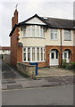
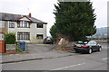
#57 Oliver Road
There is an OS benchmark Image on the side of the house by the metal gate across the drive
Image: © Roger Templeman
Taken: 8 Feb 2013
0.11 miles
4
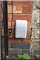
Benchmark on #57 Oliver Road
The Ordnance Survey cut mark benchmark which is partly hidded behind a Virgin Media box, is described on the Bench Mark Database at http://www.bench-marks.org.uk/bm47164
Image: © Roger Templeman
Taken: 8 Feb 2013
0.11 miles
5
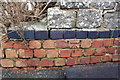
Benchmark on wall outside #99 Oliver Road
Ordnance Survey cut mark benchmark described on the Bench Mark Database at http://www.bench-marks.org.uk/bm47166
Image: © Roger Templeman
Taken: 8 Feb 2013
0.11 miles
6
#99 Oliver Road
There is an OS benchmark Image on the wall just left of the car parked on the pavement
Image: © Roger Templeman
Taken: 8 Feb 2013
0.11 miles
7
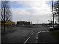
Bus turning circle, Horspath Road, Cowley (2)
Horspath Road has been split into two sections by the Oxford Eastern Bypass (just beyond the turning circle). To enable buses to continue to serve the largely residential western half of Horspath Road, a turning circle has been provided here, enabling buses on Stagecoach Oxford route 10 to do a double run along the road as they travel between the city centre and John Radcliffe Hospital. Beyond the turning circle, the other half of Horspath Road can be seen disappearing into an industrial area.
Image: © Richard Vince
Taken: 25 Jan 2014
0.12 miles
8
Bus turning circle, Horspath Road, Cowley (1)
Horspath Road has been split into two sections by the Oxford Eastern Bypass (just out of frame to the right). To enable buses to continue to serve the largely residential western half of Horspath Road, a turning circle has been provided here, enabling buses on Stagecoach Oxford route 10 to do a double run along the road as they travel between the city centre and John Radcliffe Hospital.
Image: © Richard Vince
Taken: 25 Jan 2014
0.12 miles
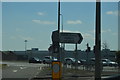
10
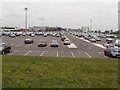
Car park of motor works, Cowley
View from Horspath road of BMW Mini works car park.
Image: © David Hawgood
Taken: 30 Jan 2007
0.17 miles