IMAGES TAKEN NEAR TO
Lydia Close, OXFORD, OX3 9HE
Introduction
This page details the photographs taken nearby to Lydia Close, OX3 9HE by members of the Geograph project.
The Geograph project started in 2005 with the aim of publishing, organising and preserving representative images for every square kilometre of Great Britain, Ireland and the Isle of Man.

There are currently over 7.5m images from over14,400 individuals and you can help contribute to the project by visiting https://www.geograph.org.uk
Image Map
Images are licensed for reuse under creativecommons.org/licenses/by-sa/2.0
Notes
- Clicking on the map will re-center to the selected point.
- The higher the marker number, the further away the image location is from the centre of the postcode.
Image Listing (42 Images Found)
Images are licensed for reuse under creativecommons.org/licenses/by-sa/2.0
Image
Details
Distance
1
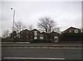
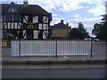
Flats on the A40 London Road, Sandhills
Image: © David Howard
Taken: 21 Feb 2016
0.01 miles
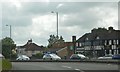
3
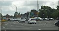
McDonald's by the Headington Roundabout
Image: © David Howard
Taken: 29 Jun 2011
0.03 miles
6
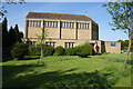
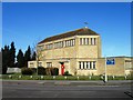
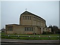
St Mary's Church, Headington
The church was built in 1958. This is the aspect that greets anyone coming from Oxford.
Image: © Bill Boaden
Taken: 3 May 2014
0.05 miles
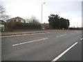
7
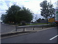
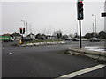
Approaching Headington Roundabout
Overlooking the Ring Road.
Image: © David Howard
Taken: 29 Jun 2011
0.05 miles