IMAGES TAKEN NEAR TO
Bonar Road, OXFORD, OX3 8RB
Introduction
This page details the photographs taken nearby to Bonar Road, OX3 8RB by members of the Geograph project.
The Geograph project started in 2005 with the aim of publishing, organising and preserving representative images for every square kilometre of Great Britain, Ireland and the Isle of Man.

There are currently over 7.5m images from over14,400 individuals and you can help contribute to the project by visiting https://www.geograph.org.uk
Image Map
Images are licensed for reuse under creativecommons.org/licenses/by-sa/2.0
Notes
- Clicking on the map will re-center to the selected point.
- The higher the marker number, the further away the image location is from the centre of the postcode.
Image Listing (21 Images Found)
Images are licensed for reuse under creativecommons.org/licenses/by-sa/2.0
Image
Details
Distance
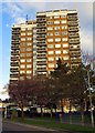
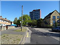
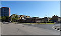
1
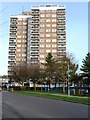
Forrester's Tower
A residential tower block in the Headington area of Oxford.
Image: © Graham Horn
Taken: 30 Jan 2008
0.10 miles
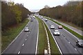

7
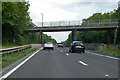
A4142 Eastern Bypass Road
Going anticlockwise around Oxford. Old Road crosses the bridge, which was presumably the old approach to Oxford from the London direction. It is no longer a through route for motor vehicles.
Image: © Robin Webster
Taken: 11 Aug 2019
0.17 miles
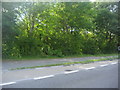
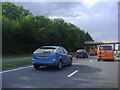
10
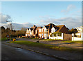
Houses in Old Road, Headington
If you're going to take a snap of something fairly ordinary, may as well do it in nice lighting. And with an old crow thrown in for good measure.
Image: © Des Blenkinsopp
Taken: 14 Feb 2013
0.19 miles