IMAGES TAKEN NEAR TO
Douglas Downes Close, OXFORD, OX3 8FS
Introduction
This page details the photographs taken nearby to Douglas Downes Close, OX3 8FS by members of the Geograph project.
The Geograph project started in 2005 with the aim of publishing, organising and preserving representative images for every square kilometre of Great Britain, Ireland and the Isle of Man.

There are currently over 7.5m images from over14,400 individuals and you can help contribute to the project by visiting https://www.geograph.org.uk
Image Map
Images are licensed for reuse under creativecommons.org/licenses/by-sa/2.0
Notes
- Clicking on the map will re-center to the selected point.
- The higher the marker number, the further away the image location is from the centre of the postcode.
Image Listing (115 Images Found)
Images are licensed for reuse under creativecommons.org/licenses/by-sa/2.0
Image
Details
Distance
1
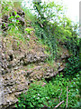
Rock Edge, Oxford
Much of Headington is built around old limestone quarries. Only one good exposure of the limestones survive, at Rock Edge (formerly Crossroads Pit), at the junction of Windmill Road and Old Road. The limestones have been quarried since the twelfth century. They provided building stones for the older houses in Oxford, as well as parts of many colleges.
Image: © 2202
Taken: 30 May 2005
0.07 miles
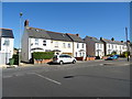
3
Quarry Road Headington
Quarry Road looking towards New Headington
Image: © Bill Nicholls
Taken: 9 Dec 2014
0.14 miles
4
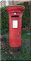
Elizabeth II postbox on Old Road, New Headington
Postbox No. OX3 719.
Image: © JThomas
Taken: 21 Sep 2019
0.14 miles
5
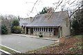
The Coach House
The coach house in Headington, used by the Holy Trinity church
Image: © Bill Nicholls
Taken: 9 Dec 2014
0.15 miles
6
Mural at the Coach House
Looks like a fish swimming through weeds and is by the entrance to the coach house Headington
Image: © Bill Nicholls
Taken: 9 Dec 2014
0.15 miles
7
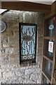
Sign for the Crown & Thistle, Headington
See Image] for context.
Image: © JThomas
Taken: 21 Sep 2019
0.16 miles
9
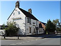
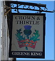
The Crown & Thistle, Headington
On Old Road.
Seems to have been closed for a while.
Image: © JThomas
Taken: 21 Sep 2019
0.16 miles
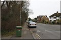
10
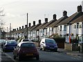
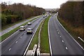
Mark Road
A typical residential street in the Headington area of Oxford.
Image: © Graham Horn
Taken: 30 Jan 2008
0.16 miles