IMAGES TAKEN NEAR TO
Shelford Place, OXFORD, OX3 7NW
Introduction
This page details the photographs taken nearby to Shelford Place, OX3 7NW by members of the Geograph project.
The Geograph project started in 2005 with the aim of publishing, organising and preserving representative images for every square kilometre of Great Britain, Ireland and the Isle of Man.

There are currently over 7.5m images from over14,400 individuals and you can help contribute to the project by visiting https://www.geograph.org.uk
Image Map
Images are licensed for reuse under creativecommons.org/licenses/by-sa/2.0
Notes
- Clicking on the map will re-center to the selected point.
- The higher the marker number, the further away the image location is from the centre of the postcode.
Image Listing (48 Images Found)
Images are licensed for reuse under creativecommons.org/licenses/by-sa/2.0
Image
Details
Distance
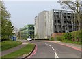
2
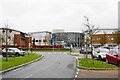
Nuffield Orthopaedic Centre
Part of Oxford University Hospitals, in a district of Oxford that has a lot of hospitals including private ones.
Image: © Bill Boaden
Taken: 4 Dec 2020
0.14 miles
3
Hemophilia center
The hemophilia center (the name is longer) at Nuffield Orthopedic Center
Image: © Bill Nicholls
Taken: 12 Oct 2024
0.15 miles
4
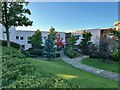
Hospital Garden
The landscaped area of Nuffield Orthopedic Hospital, one place I would think most people do not see unless you make the effort to visit
Image: © Bill Nicholls
Taken: 12 Oct 2024
0.15 miles
5
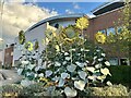
Hospital Sunflowers
Sunflower sculpture at Nuffield Orthopedic Hospital
Image: © Bill Nicholls
Taken: 12 Oct 2024
0.15 miles
6
The Nuffield Orthopaedic Hospital in Headington
Image: © Steve Daniels
Taken: 12 Nov 2009
0.15 miles
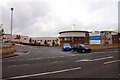
7
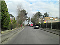
Roosevelt Drive in the Churchill Hospital
Image: © Steve Daniels
Taken: 18 Apr 2019
0.16 miles
8
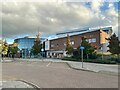
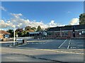
Main Entrance
The main entrance of Nuffield Orthopedic Hospital
Image: © Bill Nicholls
Taken: 12 Oct 2024
0.16 miles
9
Junction of Old Road and Lime Walk
There is an OS benchmark Image on the brick wall about 2m to the right of the junction of the low and high parts
Image: © Roger Templeman
Taken: 27 Sep 2013
0.16 miles
10
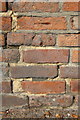
Benchmark on Old Road wall near Lime Walk junction
Ordnance Survey cut mark benchmark described on the Bench Mark Database at http://www.bench-marks.org.uk/bm51418
Image: © Roger Templeman
Taken: 27 Sep 2013
0.16 miles