IMAGES TAKEN NEAR TO
Nursery Close, OXFORD, OX3 7AG
Introduction
This page details the photographs taken nearby to Nursery Close, OX3 7AG by members of the Geograph project.
The Geograph project started in 2005 with the aim of publishing, organising and preserving representative images for every square kilometre of Great Britain, Ireland and the Isle of Man.

There are currently over 7.5m images from over14,400 individuals and you can help contribute to the project by visiting https://www.geograph.org.uk
Image Map
Images are licensed for reuse under creativecommons.org/licenses/by-sa/2.0
Notes
- Clicking on the map will re-center to the selected point.
- The higher the marker number, the further away the image location is from the centre of the postcode.
Image Listing (63 Images Found)
Images are licensed for reuse under creativecommons.org/licenses/by-sa/2.0
Image
Details
Distance
1
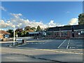
Hemophilia center
The hemophilia center (the name is longer) at Nuffield Orthopedic Center
Image: © Bill Nicholls
Taken: 12 Oct 2024
0.05 miles
2
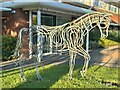
Horse sculpture
When I spotted this sculpture from the road it glowed in the evening sun at Nuffield Orthopedic Hospital
Image: © Bill Nicholls
Taken: 12 Oct 2024
0.05 miles
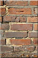
3
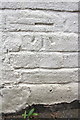
Benchmark on #104 Lime Walk
Ordnance Survey cut mark benchmark described on the Bench Mark Database at http://www.bench-marks.org.uk/bm24696
Image: © Roger Templeman
Taken: 27 Sep 2013
0.05 miles
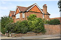
4
#104 Lime Walk, 'Eventide'
There is an OS benchmark Image on the side of the house above the alleyway between the house and the house to its right, #102
Image: © Roger Templeman
Taken: 27 Sep 2013
0.05 miles
6
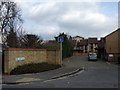
Cecil Sharp Place, Headington
A small modern development off Lime Walk that has been named after the founder of the English Folk Dance Society, Cecil Sharp, whose fortuitous meeting nearby with a Headington morris dancer on Boxing Day 1899 led to the revival of the then-dwindling morris dance and folk song tradition. William Kimber Crescent, not far away, recalls the man who Sharp happened to see performing that day - in an attempt to make a little ready cash.
Image: © Natasha Ceridwen de Chroustchoff
Taken: 1 Mar 2009
0.06 miles
7
Junction of Old Road and Lime Walk
There is an OS benchmark Image on the brick wall about 2m to the right of the junction of the low and high parts
Image: © Roger Templeman
Taken: 27 Sep 2013
0.08 miles
8
Benchmark on Old Road wall near Lime Walk junction
Ordnance Survey cut mark benchmark described on the Bench Mark Database at http://www.bench-marks.org.uk/bm51418
Image: © Roger Templeman
Taken: 27 Sep 2013
0.08 miles
9
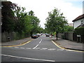
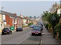
Stapleton Road
This road is one of the few roads in this country that allows (it's official) parking half on the pavement and half on the road itself.
Image: © don cload
Taken: 24 Jul 2009
0.09 miles
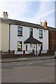
10
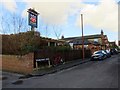
The Butchers Arms in Wilberforce Street
Image: © Steve Daniels
Taken: 7 Feb 2017
0.10 miles