IMAGES TAKEN NEAR TO
Horton-cum-Studley, OXFORD, OX33 1DE
Introduction
This page details the photographs taken nearby to OX33 1DE by members of the Geograph project.
The Geograph project started in 2005 with the aim of publishing, organising and preserving representative images for every square kilometre of Great Britain, Ireland and the Isle of Man.

There are currently over 7.5m images from over14,400 individuals and you can help contribute to the project by visiting https://www.geograph.org.uk
Image Map
Images are licensed for reuse under creativecommons.org/licenses/by-sa/2.0
Notes
- Clicking on the map will re-center to the selected point.
- The higher the marker number, the further away the image location is from the centre of the postcode.
Image Listing (28 Images Found)
Images are licensed for reuse under creativecommons.org/licenses/by-sa/2.0
Image
Details
Distance
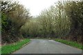
1
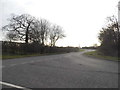
Fencott Road at the junction of Brill Road
Image: © David Howard
Taken: 20 Mar 2016
0.08 miles
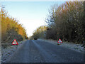
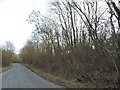
4
Brill Road
This stretch is a bit of a patchwork, highlighted by the different thermal performances of the patching material, causing different frosting and melting.
Image: © Robin Webster
Taken: 4 Dec 2016
0.10 miles
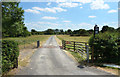
6

Lane to Furze farm
Lane to Furze farm off Boarstall to Horton-cum-Studley road
Image: © Shaun Ferguson
Taken: 28 Sep 2008
0.13 miles
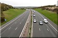
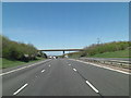
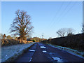
10
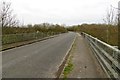
Brill Road to Horton-cum-Studley
The bridge crosses the M40.
Image: © Steve Daniels
Taken: 20 Mar 2014
0.16 miles