IMAGES TAKEN NEAR TO
Church Close, OXFORD, OX2 9NP
Introduction
This page details the photographs taken nearby to Church Close, OX2 9NP by members of the Geograph project.
The Geograph project started in 2005 with the aim of publishing, organising and preserving representative images for every square kilometre of Great Britain, Ireland and the Isle of Man.

There are currently over 7.5m images from over14,400 individuals and you can help contribute to the project by visiting https://www.geograph.org.uk
Image Map
Images are licensed for reuse under creativecommons.org/licenses/by-sa/2.0
Notes
- Clicking on the map will re-center to the selected point.
- The higher the marker number, the further away the image location is from the centre of the postcode.
Image Listing (30 Images Found)
Images are licensed for reuse under creativecommons.org/licenses/by-sa/2.0
Image
Details
Distance
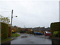
3
Fields near Farmoor
Looking east from the B4017 near the top of the square.
Image: © Tom Pullman
Taken: 27 May 2005
0.05 miles
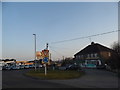
4
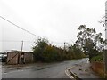
Looking from Church Close onto the B4017
Image: © Basher Eyre
Taken: 27 Oct 2020
0.06 miles
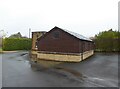
7
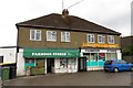
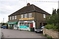
Farmoor Stores on Oxford Road
The Stores specialize in South African meats and produce.
Image: © Steve Daniels
Taken: 17 Aug 2013
0.07 miles
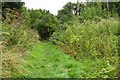
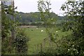
9
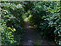
Tree lined footpath near Farmoor Reservoir
Image: © Mat Fascione
Taken: 15 Jun 2015
0.08 miles