IMAGES TAKEN NEAR TO
Dean Court Road, OXFORD, OX2 9FF
Introduction
This page details the photographs taken nearby to Dean Court Road, OX2 9FF by members of the Geograph project.
The Geograph project started in 2005 with the aim of publishing, organising and preserving representative images for every square kilometre of Great Britain, Ireland and the Isle of Man.

There are currently over 7.5m images from over14,400 individuals and you can help contribute to the project by visiting https://www.geograph.org.uk
Image Map
Images are licensed for reuse under creativecommons.org/licenses/by-sa/2.0
Notes
- Clicking on the map will re-center to the selected point.
- The higher the marker number, the further away the image location is from the centre of the postcode.
Image Listing (18 Images Found)
Images are licensed for reuse under creativecommons.org/licenses/by-sa/2.0
Image
Details
Distance
1
Cumnor Hill at entrance to 'Milestone House'
The Ordnance Survey cut a benchmark (see http://www.bench-marks.org.uk/bm20336 ) in 1856 on a milestone (2 miles from Oxford) on the far side of the road outside the present 'Milestone House'. The stone has since been lost but the house retains its name.
Image: © Roger Templeman
Taken: 23 Sep 2015
0.07 miles
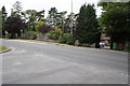
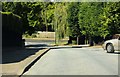
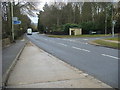
2
Junction of Cumnor Hill and Arnolds Way
A very quiet Boxing Day scene in the upmarket Oxford suburb of Cumnor Hill.
Image: © Peter Jordan
Taken: 26 Dec 2005
0.08 miles
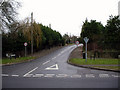
5
Arnold's Way leading down to Cumnor Hill
Image: © Steve Daniels
Taken: 27 Sep 2009
0.09 miles
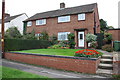
7
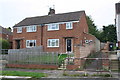
Nos. 47 and 49 Pinnocks Way
There is an OS benchmark Image on the wall at the left hand side of the path which emerges onto Pinnocks Way on the right hand side of the houses, about 9m along the path from the near end of the wall
Image: © Roger Templeman
Taken: 19 Oct 2015
0.10 miles
8
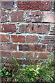
Benchmark on wall beside path to Pinnocks Way
Ordnance Survey cut mark benchmark described on the Bench Mark Database at http://www.bench-marks.org.uk/bm71177
Image: © Roger Templeman
Taken: 19 Oct 2015
0.10 miles
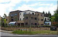
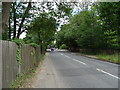
9
Cumnor Hill
Cumnor Hill passing Arnolds Way
Image: © Shaun Ferguson
Taken: 12 Mar 2010
0.12 miles
10

Benchmark on #60 Cumnor Hill
Ordnance Survey cut mark benchmark described on the Bench Mark Database at http://www.bench-marks.org.uk/bm70477
Image: © Roger Templeman
Taken: 23 Sep 2015
0.13 miles