IMAGES TAKEN NEAR TO
Idbury Close, WITNEY, OX28 5FE
Introduction
This page details the photographs taken nearby to Idbury Close, OX28 5FE by members of the Geograph project.
The Geograph project started in 2005 with the aim of publishing, organising and preserving representative images for every square kilometre of Great Britain, Ireland and the Isle of Man.

There are currently over 7.5m images from over14,400 individuals and you can help contribute to the project by visiting https://www.geograph.org.uk
Image Map (Loading...)


Getting Data...Please wait
Leaflet Map data © OpenStreetMap
Images are licensed for reuse under creativecommons.org/licenses/by-sa/2.0
Notes
- Clicking on the map will re-center to the selected point.
- The higher the marker number, the further away the image location is from the centre of the postcode.
Image Listing (9 Images Found)
Images are licensed for reuse under creativecommons.org/licenses/by-sa/2.0
Image
Details
Distance

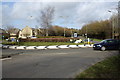
3
Witney - Deer Park Road from the A4095 roundabout
Image: © Peter Whatley
Taken: 15 Oct 2011
0.13 miles
4
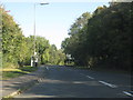
Witney - Curbridge Road (A4095) on the town's outskirts
Image: © Peter Whatley
Taken: 15 Oct 2011
0.16 miles
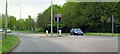
6
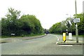
How many men does it take to plant a bulb?
Roundabout where Curbridge Road meets Thorney Leys (right) and Deer Park Road (left)
Image: © Roger Templeman
Taken: 10 Mar 2011
0.21 miles
8
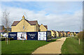
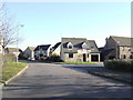
Path to the new houses
A pathway from Curbridge Road into the large new housing estate north of here.
Image: © Des Blenkinsopp
Taken: 15 Oct 2020
0.23 miles
9
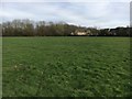
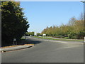
Open Space
From Valence Crescent the open space up to the path to Edington Road
Image: © Shaun Ferguson
Taken: 9 Mar 2019
0.23 miles