IMAGES TAKEN NEAR TO
Woodstock Road, OXFORD, OX2 6HQ
Introduction
This page details the photographs taken nearby to Woodstock Road, OX2 6HQ by members of the Geograph project.
The Geograph project started in 2005 with the aim of publishing, organising and preserving representative images for every square kilometre of Great Britain, Ireland and the Isle of Man.

There are currently over 7.5m images from over14,400 individuals and you can help contribute to the project by visiting https://www.geograph.org.uk
Image Map
Images are licensed for reuse under creativecommons.org/licenses/by-sa/2.0
Notes
- Clicking on the map will re-center to the selected point.
- The higher the marker number, the further away the image location is from the centre of the postcode.
Image Listing (501 Images Found)
Images are licensed for reuse under creativecommons.org/licenses/by-sa/2.0
Image
Details
Distance
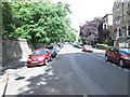
1
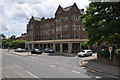
Observatory Street - Woodstock Road
Image: © Betty Longbottom
Taken: 12 Aug 2013
0.01 miles
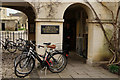
2
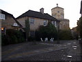
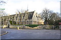
Lankester Quad, Green Templeton College
The college came into being in 2008 as a result of a merger between Green College and Templeton College (both named after their benefactors), and occupies the location of the C18 Oxford Observatory seen here in the background at dusk. Some of the buildings date from that period while additions were aimed at being architecturally compatible.
Image: © Natasha Ceridwen de Chroustchoff
Taken: 3 Nov 2009
0.02 miles
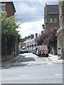
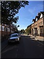
3
St Bernard's Road - Woodstock Road
Image: © Betty Longbottom
Taken: 12 Aug 2013
0.03 miles
4
Oxford : Belsyre Court
Belsyre Court is a listed early 20th-century block of flats in Oxford.
Image: © Lewis Clarke
Taken: 29 Jun 2014
0.04 miles
5
Green Templeton College, Oxford
Oxford's newest college, founded in 2008. A graduate-only college, aiming to set a new Oxford standard for postgraduate education.
Image: © Peter Trimming
Taken: 15 Mar 2016
0.04 miles
7
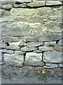
Benchmark on wall at junction of Bevington Road and Woodstock Road
Ordnance Survey cut mark benchmark described on the Bench Mark Database at http://www.bench-marks.org.uk/bm28722.
Image: © Roger Templeman
Taken: 13 Aug 2010
0.05 miles
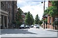
8
Junction of Woodstock Road and Bevington Road
There is an OS benchmark Image on the curved part of the wall at the junction
Image: © Roger Templeman
Taken: 15 Dec 2014
0.05 miles
9
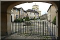
Green Templeton College
Green Templeton College with the Radcliffe Observatory framed by the entrance arch.
Image: © Philip Halling
Taken: 4 Feb 2023
0.05 miles