IMAGES TAKEN NEAR TO
St. Johns Street, BICESTER, OX26 6SQ

Introduction

This page details the photographs taken nearby to St. Johns Street, OX26 6SQ by members of the Geograph project.

The Geograph project started in 2005 with the aim of publishing, organising and preserving representative images for every square kilometre of Great Britain, Ireland and the Isle of Man.

There are currently over 7.5m images from over14,400 individuals and you can help contribute to the project by visiting https://www.geograph.org.uk

Image Map


Images are licensed for reuse under creativecommons.org/licenses/by-sa/2.0
Notes
  • Clicking on the map will re-center to the selected point.
  • The higher the marker number, the further away the image location is from the centre of the postcode.

Image Listing (118 Images Found)

Images are licensed for reuse under creativecommons.org/licenses/by-sa/2.0
  • ...
Image
Details
Distance
1
Left here for Bucknell and local shops, Bicester
At the edge of the B4100 at the Bucknell Road http://www.geograph.org.uk/photo/4564414 junction.
Image: © Jaggery Taken: 9 Jul 2015
0.01 miles
2
Fane House, Bicester
This is sheltered housing
Image: © David Howard Taken: 1 Aug 2021
0.02 miles
3
Former shop on Field Street
Image: © Robert Eva Taken: 23 Mar 2017
0.02 miles
4
Benchmark on #4 Crockwell Close
Ordnance Survey cut mark benchmark described on the Bench Mark Database at http://www.bench-marks.org.uk/bm33925
Image: © Roger Templeman Taken: 4 Nov 2013
0.02 miles
5
#4 Crockwell Close - formerly a school?
There is an OS benchmark Image on the bricks at the front left hand corner of the building
Image: © Roger Templeman Taken: 4 Nov 2013
0.02 miles
6
Former Bicester Primary School
Located on the corner at the SE end of Bucknell Road, near Crockwell Close. Built in 1836 as Bicester Primary School, known locally as Crockwell School. Converted to four houses in the 1970s. The name plates on the right show CROCKWELL COTTAGE NO. 2 and OLD SCHOOL COTTAGE.
Image: © Jaggery Taken: 9 Jul 2015
0.03 miles
7
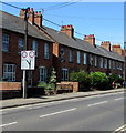
Hailles Gardens, Bicester
Houses viewed across St John's Street.
Image: © Jaggery Taken: 9 Jul 2015
0.03 miles
8
Junction sign, Field Street, Bicester
On the approach to a fork in the road. A quarter of a mile ahead, the left fork passes under a railway bridge with headroom shown as 4.5 metres (14' 5"). The right fork route bridge's headroom is shown as 4.6 metres (15' 3"). The equivalent heights don't exactly tally because a tenth of a metre is 4 inches whereas the height difference shown is 10 inches.
Image: © Jaggery Taken: 9 Jul 2015
0.03 miles
9
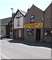
Sunrise in Bicester
Chinese takeaway at 37 North Street.
Image: © Jaggery Taken: 9 Jul 2015
0.04 miles
10
South along North Street, Bicester
From the corner of Field Street. The Plough http://www.geograph.org.uk/photo/3136491 is on the right.
Image: © Jaggery Taken: 9 Jul 2015
0.04 miles
  • ...