IMAGES TAKEN NEAR TO
Tamar Crescent, BICESTER, OX26 2HZ
Introduction
This page details the photographs taken nearby to Tamar Crescent, OX26 2HZ by members of the Geograph project.
The Geograph project started in 2005 with the aim of publishing, organising and preserving representative images for every square kilometre of Great Britain, Ireland and the Isle of Man.

There are currently over 7.5m images from over14,400 individuals and you can help contribute to the project by visiting https://www.geograph.org.uk
Image Map
Images are licensed for reuse under creativecommons.org/licenses/by-sa/2.0
Notes
- Clicking on the map will re-center to the selected point.
- The higher the marker number, the further away the image location is from the centre of the postcode.
Image Listing (16 Images Found)
Images are licensed for reuse under creativecommons.org/licenses/by-sa/2.0
Image
Details
Distance
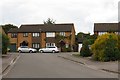
2
King's Meadow Primary School, Bicester
Image: © Sarah Charlesworth
Taken: 13 Nov 2009
0.10 miles
3
Shakespeare Drive in Bicester
Heading north-east to Howes Lane.
Image: © Steve Daniels
Taken: 1 Jul 2014
0.10 miles
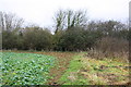
4
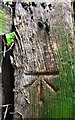
Benchmark on wooden gatepost in Howes Lane hedge
Ordnance Survey cut mark benchmark described on the Bench Mark Database at http://www.bench-marks.org.uk/bm91576
Image: © Roger Templeman
Taken: 22 Dec 2017
0.14 miles
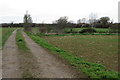
6
Corner of fodder crop field beside A4095
There is an OS benchmark Image on a wooden gatepost in the hedge
Image: © Roger Templeman
Taken: 22 Dec 2017
0.14 miles
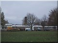
7
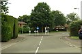
Looking down Blythe Place to a mini-roundabout
Wansbeck Drive is to the left, Dryden Avenue is straight on, and Greenwood Drive is to the right.
Image: © Steve Daniels
Taken: 1 Jul 2014
0.15 miles
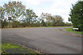
8
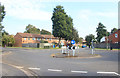
Small Suburban Roundabout
Looking from Wansbeck Drive to Greenwood Drive.
Image: © Des Blenkinsopp
Taken: 15 Sep 2020
0.15 miles
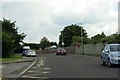
9
Junction of Shakespeare Drive with Howes Lane
Howes Lane is the A4095 which encircles the NW limit of urbanised Bicester
Image: © Roger Templeman
Taken: 4 Nov 2013
0.15 miles
10
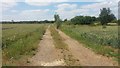
Drive up to Gowell Farm
Off Howes Lane the drive up to Gowell Farm
Image: © Shaun Ferguson
Taken: 3 Jul 2019
0.16 miles