1
Benchmark on #24 Shipton Road
Ordnance Survey cut mark benchmark described on the Bench Mark Database at http://www.bench-marks.org.uk/bm61450
Image: © Roger Templeman
Taken: 20 Oct 2014
0.08 miles
2
Semidetached houses on Shipton Road
There is an OS benchmark
Image on the left hand side of the original house at the junction with the extension.
Image: © Roger Templeman
Taken: 20 Oct 2014
0.09 miles
3
Home time
Pupils streaming down the road from Hensington School, Woodstock.
Image: © Jonathan Billinger
Taken: 25 Jan 2007
0.09 miles
4
Princes Ride, Woodstock
Looking ENE from the corner of Crecy Walk.
Image: © Jaggery
Taken: 20 Jun 2015
0.11 miles
5
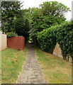
Willoughby Way, Woodstock
Path north from Princes Ride towards Recreation Road.
Image: © Jaggery
Taken: 20 Jun 2015
0.13 miles
6
Junction of Princes Ride and Crecy Walk, Woodstock
Looking across Princes Ride. The name sign next to
a tree shows CRECY WALK LEADING TO THE COVERT.
Image: © Jaggery
Taken: 20 Jun 2015
0.14 miles
7
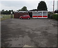
Worn-out Youth Centre building in Woodstock
The shabby appearance of the building seen here in June 2015 is not apparent from the entrance side. http://www.geograph.org.uk/photo/4533371
The Woodstock Youth Club website states that a new youth centre is planned, to serve Woodstock and the surrounding area, a massive undertaking for a small youth club. The Fundraising Target is £350,000.
By the May 2015 AGM over £100,000 had been raised - a promising start but still a long way to go.
Image: © Jaggery
Taken: 20 Jun 2015
0.14 miles
8
Woodstock Youth Centre, Recreation Road,Woodstock
The Youth Centre is the venue for Woodstock Youth Club's weekly club night, every Tuesday from 6pm-8.30pm. Activities range from energetic (dodgeball, indoor football, basketball and roller hockey) to the more peaceful art & craft room. The tuck shop sells hot snacks and cold drinks. The club is open to everyone aged 8-16 living in Woodstock or the surrounding villages.
Image: © Jaggery
Taken: 20 Jun 2015
0.15 miles
9
Outdoor activity area, Woodstock Church of England Primary School
Viewed over the Recreation Road perimeter fence in Woodstock.
Image: © Jaggery
Taken: 20 Jun 2015
0.15 miles
10
Recreation Road, Woodstock
From the corner of New Road.
Image: © Jaggery
Taken: 20 Jun 2015
0.15 miles


