
IMAGES TAKEN NEAR TO
Lord Close, CARTERTON, OX18 3PF
Introduction
This page details the photographs taken nearby to Lord Close, OX18 3PF by members of the Geograph project.
The Geograph project started in 2005 with the aim of publishing, organising and preserving representative images for every square kilometre of Great Britain, Ireland and the Isle of Man.

There are currently over 7.5m images from over14,400 individuals and you can help contribute to the project by visiting https://www.geograph.org.uk
Image Map
Images are licensed for reuse under creativecommons.org/licenses/by-sa/2.0
Notes
- Clicking on the map will re-center to the selected point.
- The higher the marker number, the further away the image location is from the centre of the postcode.
Image Listing (22 Images Found)
Images are licensed for reuse under creativecommons.org/licenses/by-sa/2.0
Image
Details
Distance
1
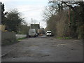
Rough stretch of road
In Carterton, linking Rock Road, and Rock Close. A sign just out of shot gives this as a private road.
Image: © andrew auger
Taken: 13 Dec 2009
0.09 miles
3
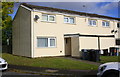
Houses on Kestrel Close
There is an OS benchmark Image at the base of the downpipe on the near corner of the near house
Image: © Roger Templeman
Taken: 18 Oct 2016
0.14 miles
4
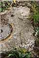
Benchmark on drain cover at #1 Kestrel Close
Ordnance Survey rivet benchmark described on the Bench Mark Database at http://www.bench-marks.org.uk/bm79745
Image: © Roger Templeman
Taken: 18 Oct 2016
0.15 miles
5
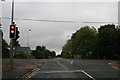
Traffic lights in Carterton
Upavon way meets the Burford Road (to the right) and Shilton Road (to the left)
Image: © andrew auger
Taken: 3 Oct 2009
0.15 miles
6
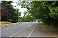
Junction of Burford Road, Upavon Way and Shilton Road, Carterton, Oxon
The junction of the three roads is controlled by traffic lights. In the foreground is Burford Road. The road going from left to right is Upavon Way (B4477). Straight ahead, in the distance, is Shilton Road (B4020). This goes to Burford.
Image: © P L Chadwick
Taken: 4 Jun 2020
0.15 miles
7
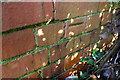
Benchmark on wall of Upavon Way at Burford Road junction
Ordnance Survey cut mark benchmark described on the Bench Mark Database at http://www.bench-marks.org.uk/bm79883
Image: © Roger Templeman
Taken: 20 Feb 2017
0.16 miles
8
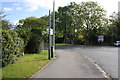
Junction of Upavon Way and Burford Road
There is an OS benchmark Image on the wall behind the bush on the far side of the gap between the two bushes at the left hand side of the image
Image: © Roger Templeman
Taken: 18 Oct 2016
0.16 miles
9
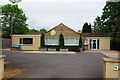
Burford Road Dental, 50 Burford Road, Carterton, Oxon
A dental practice which caters for both private and NHS patients.
Image: © P L Chadwick
Taken: 4 Jun 2020
0.17 miles
10
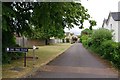
Lime Tree Close, Carterton, Oxon
A residential cul-de-sac off Burford Road.
Image: © P L Chadwick
Taken: 4 Jun 2020
0.18 miles