IMAGES TAKEN NEAR TO
Lew, BAMPTON, OX18 2BB
Introduction
This page details the photographs taken nearby to OX18 2BB by members of the Geograph project.
The Geograph project started in 2005 with the aim of publishing, organising and preserving representative images for every square kilometre of Great Britain, Ireland and the Isle of Man.

There are currently over 7.5m images from over14,400 individuals and you can help contribute to the project by visiting https://www.geograph.org.uk
Image Map (Loading...)


Getting Data...Please wait
Leaflet Map data © OpenStreetMap
Images are licensed for reuse under creativecommons.org/licenses/by-sa/2.0
Notes
- Clicking on the map will re-center to the selected point.
- The higher the marker number, the further away the image location is from the centre of the postcode.
Image Listing (11 Images Found)
Images are licensed for reuse under creativecommons.org/licenses/by-sa/2.0
Image
Details
Distance
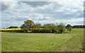
4
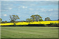
Footpath past Hill View
And on towards Ducklington.
Image: © Jonathan Billinger
Taken: 23 Jan 2007
0.17 miles
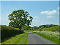
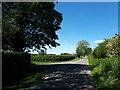
6
Mount Owen Road
At its northern end, near Lew.
Image: © andrew auger
Taken: 11 Oct 2009
0.19 miles
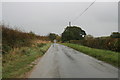
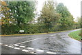
7
Junction of Mount Owen Road with road to Lew
Image: © Vieve Forward
Taken: 5 Jun 2021
0.21 miles
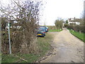
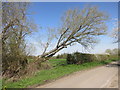
8

Footpath to Ducklington
It's about a 2 to 3 Km walk through the fields to Ducklington from the scatter of houses around Lew.
Image: © Des Blenkinsopp
Taken: 23 Apr 2017
0.22 miles
10
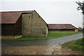
Manor Farm
Off Mount Owen road, near Lew.
Image: © andrew auger
Taken: 11 Oct 2009
0.23 miles