IMAGES TAKEN NEAR TO
Millers Way, BANBURY, OX17 2GA
Introduction
This page details the photographs taken nearby to Millers Way, OX17 2GA by members of the Geograph project.
The Geograph project started in 2005 with the aim of publishing, organising and preserving representative images for every square kilometre of Great Britain, Ireland and the Isle of Man.

There are currently over 7.5m images from over14,400 individuals and you can help contribute to the project by visiting https://www.geograph.org.uk
Image Map (Loading...)


Getting Data...Please wait
Leaflet Map data © OpenStreetMap
Images are licensed for reuse under creativecommons.org/licenses/by-sa/2.0
Notes
- Clicking on the map will re-center to the selected point.
- The higher the marker number, the further away the image location is from the centre of the postcode.
Image Listing (58 Images Found)
Images are licensed for reuse under creativecommons.org/licenses/by-sa/2.0
Image
Details
Distance
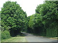
1
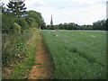
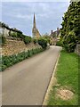
Seven Shires Way
Seven Shires Way heading towards All Saints church Middleton Cheney
Image: © Shaun Ferguson
Taken: 19 Jun 2011
0.05 miles
3
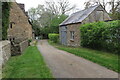
Footpath out of Middleton Cheney by Springfield House
Image: © Philip Jeffrey
Taken: 2 May 2022
0.13 miles
4
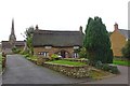
Middleton Cheney-Glovers Lane
Thatched Cottage and All Saints Church.
Image: © Ian Rob
Taken: 12 Oct 2019
0.13 miles
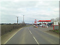
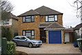
6
Road through the outskirts of Middleton Cheney
Image: © Sarah Charlesworth
Taken: 6 May 2011
0.14 miles
7
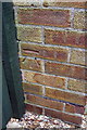
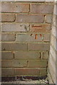
Benchmark on #8 Chacombe Road
Ordnance Survey cut mark benchmark described on the Bench Mark Database at http://www.bench-marks.org.uk/bm48294
Image: © Roger Templeman
Taken: 24 Apr 2013
0.15 miles
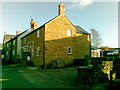
8
#8 Chacombe Road
There is an OS benchmark Image on the left hand side of the house just before the side path gate
Image: © Roger Templeman
Taken: 24 Apr 2013
0.15 miles
10
Benchmark on #46 Chacombe Road, 'Bob's Ground'
Ordnance Survey cut mark benchmark described on the Bench Mark Database at http://www.bench-marks.org.uk/bm48295
Image: © Roger Templeman
Taken: 24 Apr 2013
0.16 miles