
IMAGES TAKEN NEAR TO
Coppice Close, BANBURY, OX16 9SP
Introduction
This page details the photographs taken nearby to Coppice Close, OX16 9SP by members of the Geograph project.
The Geograph project started in 2005 with the aim of publishing, organising and preserving representative images for every square kilometre of Great Britain, Ireland and the Isle of Man.

There are currently over 7.5m images from over14,400 individuals and you can help contribute to the project by visiting https://www.geograph.org.uk
Image Map
Images are licensed for reuse under creativecommons.org/licenses/by-sa/2.0
Notes
- Clicking on the map will re-center to the selected point.
- The higher the marker number, the further away the image location is from the centre of the postcode.
Image Listing (55 Images Found)
Images are licensed for reuse under creativecommons.org/licenses/by-sa/2.0
Image
Details
Distance
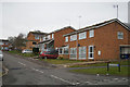
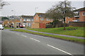
3
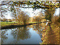
Oxford Canal on the edge of Banbury
From this direction the canal gets quite close in to the centre of Banbury before the buildings close in around it.
Image: © Des Blenkinsopp
Taken: 17 Dec 2018
0.11 miles
4
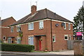
Semi-detached houses on Lime Avenue
There is an OS benchmark Image on the side of the near house left of its black downpipe
Image: © Roger Templeman
Taken: 29 Apr 2014
0.12 miles
5
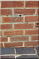
Benchmark on the side of #9 Lime Avenue
Ordnance Survey cut mark benchmark described on the Bench Mark Database at http://www.bench-marks.org.uk/bm57127
Image: © Roger Templeman
Taken: 29 Apr 2014
0.12 miles

9

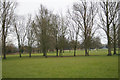
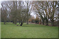
Winding hole south of Banbury
'Winding hole' is canal jargon for a turning point and is pronounced as in wind, the weather phenomenon. This one can be used for turning long boats but is unusually narrow and awkward.
Image: © Stephen McKay
Taken: 7 Jul 2020
0.13 miles
10
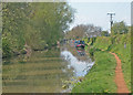
Oxford Canal
This southern section of the Oxford canal has remained largely unchanged since its construction in the 1770s. Largely following the contours of the land through which it runs, it was built to link the Coventry coalfields to the River Thames at Oxford.
Image: © Dennis Turner
Taken: 24 Apr 2004
0.13 miles