IMAGES TAKEN NEAR TO
Valley Road, BANBURY, OX16 9BH
Introduction
This page details the photographs taken nearby to Valley Road, OX16 9BH by members of the Geograph project.
The Geograph project started in 2005 with the aim of publishing, organising and preserving representative images for every square kilometre of Great Britain, Ireland and the Isle of Man.

There are currently over 7.5m images from over14,400 individuals and you can help contribute to the project by visiting https://www.geograph.org.uk
Image Map
Images are licensed for reuse under creativecommons.org/licenses/by-sa/2.0
Notes
- Clicking on the map will re-center to the selected point.
- The higher the marker number, the further away the image location is from the centre of the postcode.
Image Listing (105 Images Found)
Images are licensed for reuse under creativecommons.org/licenses/by-sa/2.0
Image
Details
Distance
1
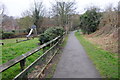
Green Lane, Banbury
Green Lane is a footpath through an estate to the rear of Morrisons supermarket in Banbury.
Image: © Philip Halling
Taken: 9 Mar 2013
0.06 miles
2
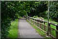
Footpath behind Morrisons supermarket
The lamp post really is leaning to the right.
Image: © David Martin
Taken: 27 Apr 2019
0.07 miles
3
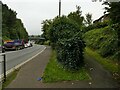
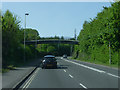
Path to the footbridge over Upper Windsor Street
The bridge in the distance carries Green Lane, a public bridleway Image
Image: © Stephen Craven
Taken: 22 Sep 2021
0.09 miles
4
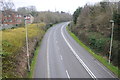
Upper Windsor Street, Banbury
View to the south-west along Upper Windsor Street in Banbury, viewed from the Green Lane Footbridge.
Image: © Philip Halling
Taken: 9 Mar 2013
0.10 miles
6
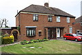
Nos. 54 and 56 Hightown Road
There is an OS benchmark Image on the side of the left hand house just through the brick arch and behind a trellis
Image: © Roger Templeman
Taken: 29 Apr 2014
0.11 miles
7
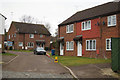
Valley Road, Banbury
Viewed from the Hightown Road end.
Image: © Jaggery
Taken: 18 Oct 2014
0.11 miles
9
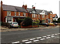
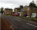
Hightown Road houses in Banbury
Between Foscote Rise and Green Lane.
Image: © Jaggery
Taken: 18 Oct 2014
0.11 miles
10
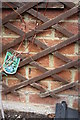
Benchmark behind trellis on side of #56 Hightown Road
Ordnance Survey cut mark benchmark described on the Bench Mark Database at http://www.bench-marks.org.uk/bm57126
Image: © Roger Templeman
Taken: 29 Apr 2014
0.11 miles