
IMAGES TAKEN NEAR TO
School View, BANBURY, OX16 4SR
Introduction
This page details the photographs taken nearby to School View, OX16 4SR by members of the Geograph project.
The Geograph project started in 2005 with the aim of publishing, organising and preserving representative images for every square kilometre of Great Britain, Ireland and the Isle of Man.

There are currently over 7.5m images from over14,400 individuals and you can help contribute to the project by visiting https://www.geograph.org.uk
Image Map
Images are licensed for reuse under creativecommons.org/licenses/by-sa/2.0
Notes
- Clicking on the map will re-center to the selected point.
- The higher the marker number, the further away the image location is from the centre of the postcode.
Image Listing (99 Images Found)
Images are licensed for reuse under creativecommons.org/licenses/by-sa/2.0
Image
Details
Distance
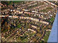
2
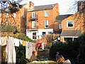
Middleton Road Houses from back gardens
Rear view of some Middleton Road terraces from one of remaining back gardens.
Image: © David Vere
Taken: 19 Mar 2005
0.09 miles
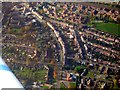
4
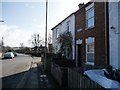
Terraced houses, south side of The Causeway, Grimsbury
At the point where houses built in the 1800s give way to ones built in the 1900s.
Image: © Christine Johnstone
Taken: 30 Mar 2015
0.10 miles
5
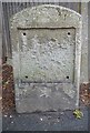
Old Milestone by the former A422, Middleton Road, Grimsbury, Banbury Parish
Stone post (plate lost) by the UC road (was A422), in parish of BANBURY (CHERWELL District), Middleton Road, Grimsbury, by No.46, in pavement, on East side of road. Brackley tombstone & iron plate, erected by the Buckingham, Brackley, Banbury turnpike trust in the 19th century.
Inscription once read:-
: (Brackley 9) :
Milestone Society National ID: OX_BABR00.
Image: © R Caldicott
Taken: 1 Jul 2011
0.11 miles
6
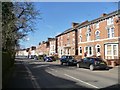
Three-storey terraced housing, Middleton Road
Now mostly converted into flats.
Image: © Christine Johnstone
Taken: 30 Mar 2015
0.11 miles
7
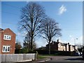
Mature trees, Grimsbury
At the junction of Howard Road and The Causeway.
Image: © Christine Johnstone
Taken: 30 Mar 2015
0.11 miles
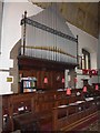
9

St Leonard, Grimsbury: Fourth Station of the Cross
Image: © Basher Eyre
Taken: 21 Sep 2015
0.11 miles
10

St Leonard, Grimsbury: Third Station of the Cross
Image: © Basher Eyre
Taken: 21 Sep 2015
0.11 miles