IMAGES TAKEN NEAR TO
Butts Field, BANBURY, OX16 1HQ
Introduction
This page details the photographs taken nearby to Butts Field, OX16 1HQ by members of the Geograph project.
The Geograph project started in 2005 with the aim of publishing, organising and preserving representative images for every square kilometre of Great Britain, Ireland and the Isle of Man.

There are currently over 7.5m images from over14,400 individuals and you can help contribute to the project by visiting https://www.geograph.org.uk
Image Map
Images are licensed for reuse under creativecommons.org/licenses/by-sa/2.0
Notes
- Clicking on the map will re-center to the selected point.
- The higher the marker number, the further away the image location is from the centre of the postcode.
Image Listing (9 Images Found)
Images are licensed for reuse under creativecommons.org/licenses/by-sa/2.0
Image
Details
Distance
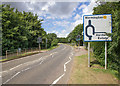
1
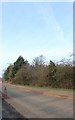
Warwick Road, Drayton
A little resurfacing is going on here.
Image: © David Howard
Taken: 9 Feb 2019
0.12 miles
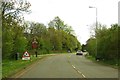
2
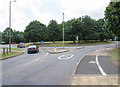
Roundabout at the end of Highlands
The roundabout on the B4100 Warwick Road junction with Highlands.
Image: © David P Howard
Taken: 3 Aug 2013
0.14 miles
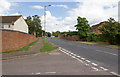
3
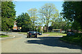
Roundabout on B4100 Warwick Road, Banbury
Serving a residential area off to the left.
Image: © Robin Webster
Taken: 30 May 2021
0.14 miles
4
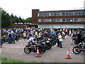
Drayton School
Participants in the 2006 Banbury Run, gathered before the start, in the car park of Drayton School.
From September 2007 Drayton School became North Oxfordshire Academy.
Image: © E Gammie
Taken: 18 Jun 2006
0.18 miles
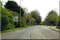
5
Pedestrian crossing on Warwick Road
A traffic light controlled crossing just before the roundabout junction with Highlands, on the B4100 Warwick Road.
Image: © David P Howard
Taken: 3 Aug 2013
0.19 miles
7
Highlands, Banbury
Looking ENE up Highlands past the junction with Hardwick Park.
Image: © David P Howard
Taken: 3 Aug 2013
0.22 miles
9
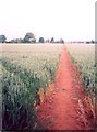
Footpath, Drayton
A footpath to Drayton village cutting diagonally through a field of wheat. Looking towards Drayton, from near the gate into the field by Drayton School on the A422.
Image: © E Gammie
Taken: 18 Jun 2006
0.25 miles