IMAGES TAKEN NEAR TO
White Barn, OXFORD, OX1 5HH
Introduction
This page details the photographs taken nearby to White Barn, OX1 5HH by members of the Geograph project.
The Geograph project started in 2005 with the aim of publishing, organising and preserving representative images for every square kilometre of Great Britain, Ireland and the Isle of Man.

There are currently over 7.5m images from over14,400 individuals and you can help contribute to the project by visiting https://www.geograph.org.uk
Image Map
Images are licensed for reuse under creativecommons.org/licenses/by-sa/2.0
Notes
- Clicking on the map will re-center to the selected point.
- The higher the marker number, the further away the image location is from the centre of the postcode.
Image Listing (6 Images Found)
Images are licensed for reuse under creativecommons.org/licenses/by-sa/2.0
Image
Details
Distance
3
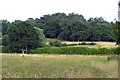
Pasture, Wootton
The edge of Youlbury Wood viewed from a footpath between Boars Hill and Cumnor.
Image: © Andrew Smith
Taken: 16 May 2009
0.19 miles
4
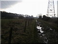
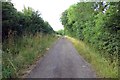
Bridleway to Henwood Farm
A muddy bridleway to Henwood Farm passing the electric pylon
Image: © Shaun Ferguson
Taken: 22 Jan 2011
0.19 miles