
IMAGES TAKEN NEAR TO
Horley Path Road, BANBURY, OX15 6QA
Introduction
This page details the photographs taken nearby to Horley Path Road, OX15 6QA by members of the Geograph project.
The Geograph project started in 2005 with the aim of publishing, organising and preserving representative images for every square kilometre of Great Britain, Ireland and the Isle of Man.

There are currently over 7.5m images from over14,400 individuals and you can help contribute to the project by visiting https://www.geograph.org.uk
Image Map
Images are licensed for reuse under creativecommons.org/licenses/by-sa/2.0
Notes
- Clicking on the map will re-center to the selected point.
- The higher the marker number, the further away the image location is from the centre of the postcode.
Image Listing (102 Images Found)
Images are licensed for reuse under creativecommons.org/licenses/by-sa/2.0
Image
Details
Distance
1
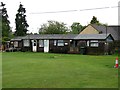
Wroxton Cricket Club
The pavilion of Wroxton Cricket Club.
Image: © Richard Green
Taken: 15 May 2013
0.02 miles
2
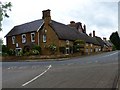
Wroxton House Hotel
Wroxton House Hotel sprawls round a corner of the A422
Image: © Richard Green
Taken: 27 May 2011
0.05 miles
3
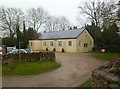
Wroxton Village Hall
Off Stratford Road: http://www.wroxton.org.uk/page27.html
Image: © Mike Faherty
Taken: 3 Mar 2012
0.05 miles
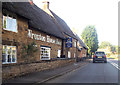
6
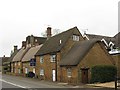
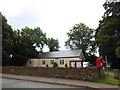
Wroxton House Hotel
This excellent hotel has been created from a remarkable collection of buildings.
Image: © Richard Green
Taken: 17 May 2013
0.05 miles
7
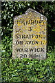
Milestone on north side of the A422
Milestone in parish of WROXTON (CHERWELL District), Stratford Road; opposite White Horse PH, in hedge behind wide cut verge. Wroxton red tombstone, erected by the Drayton Lane to Edgehill turnpike trust in the 18th century.
Inscription reads:-
BANBURY
3.
STRATFORD
ON AVON 17.
WARWICK
20 Miles.
Oxfordshire HER.
HER Number: 10130 https://www.heritagegateway.org.uk/Gateway/Results_Single.aspx?uid=MOX4213&resourceID=1033
The stone has Milestone Society National ID: OX_BASF03
Image: © Roger Templeman
Taken: 20 Apr 2016
0.05 miles
8
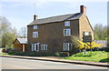
'Black Swan House', Stratford Road
There is an OS benchmark Image on the near corner of the house, on the road face
Image: © Roger Templeman
Taken: 20 Apr 2016
0.05 miles
9

Victorian house on Stratford Road, Wroxton
Image: © David Howard
Taken: 3 Jun 2018
0.05 miles
10
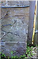
Benchmark on 'Black Swan House', Stratford Road
Ordnance Survey cut mark benchmark described on the Bench Mark Database at http://www.bench-marks.org.uk/bm75070
Image: © Roger Templeman
Taken: 20 Apr 2016
0.06 miles