IMAGES TAKEN NEAR TO
Shenington, BANBURY, OX15 6HW
Introduction
This page details the photographs taken nearby to OX15 6HW by members of the Geograph project.
The Geograph project started in 2005 with the aim of publishing, organising and preserving representative images for every square kilometre of Great Britain, Ireland and the Isle of Man.

There are currently over 7.5m images from over14,400 individuals and you can help contribute to the project by visiting https://www.geograph.org.uk
Image Map (Loading...)


Getting Data...Please wait
Leaflet Map data © OpenStreetMap
Images are licensed for reuse under creativecommons.org/licenses/by-sa/2.0
Notes
- Clicking on the map will re-center to the selected point.
- The higher the marker number, the further away the image location is from the centre of the postcode.
Image Listing (14 Images Found)
Images are licensed for reuse under creativecommons.org/licenses/by-sa/2.0
Image
Details
Distance
2
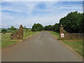
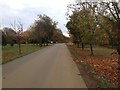
Sugarswell Business Park
The drive to the business park, formerly Sugarswell Farm, turns left here from the driveway from Sugarswell Lane in the NE corner of this square and heads towards the buildings in the next square.
Image: © David Stowell
Taken: 11 Jun 2006
0.11 miles
3
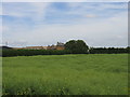
Beet field, Sugarswell
Some sort of beet in a field by the bridleway past Sugarswell Business Park.
Image: © Derek Harper
Taken: 29 Oct 2009
0.13 miles
5
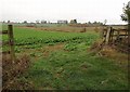
Sugarswell Farm
Looking across from the bridleway to Shenington towards the main farm buildings. The farm is now the site of Sugarswell Business Park.
Image: © David Stowell
Taken: 11 Jun 2006
0.16 miles
6
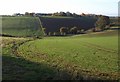
Combe, Sugarswell
The valley of one of the headwaters of the Sor Brook, a tributary of the Cherwell, seen from the Macmillan Way. Beyond is Sugarswell Business Park, in Image, formerly a farm.
Image: © Derek Harper
Taken: 28 Oct 2009
0.16 miles
7
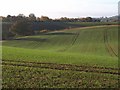
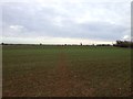
Winter wheat by the Macmillan Way (2)
Taken further east across the same field as Image; the field embraces a side combe of one of the tributaries of the Sor Brook. The building on the extreme left is at Sugarswell Business Park in Image
Image: © Derek Harper
Taken: 28 Oct 2009
0.19 miles
8
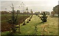
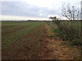
Young trees, Sugarswell Business Park
These rows of trees promise to form an extra avenue by the drive to the business park, also followed by the bridleway to Shenington.
Image: © Derek Harper
Taken: 29 Oct 2009
0.20 miles
9
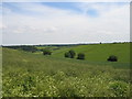
View from the Macmillan Way
Looking from this long distance path as it heads off in an ESE direction across the rolling countryside.
Image: © David Stowell
Taken: 11 Jun 2006
0.22 miles