
IMAGES TAKEN NEAR TO
New Road, BANBURY, OX15 6DN
Introduction
This page details the photographs taken nearby to New Road, OX15 6DN by members of the Geograph project.
The Geograph project started in 2005 with the aim of publishing, organising and preserving representative images for every square kilometre of Great Britain, Ireland and the Isle of Man.

There are currently over 7.5m images from over14,400 individuals and you can help contribute to the project by visiting https://www.geograph.org.uk
Image Map
Images are licensed for reuse under creativecommons.org/licenses/by-sa/2.0
Notes
- Clicking on the map will re-center to the selected point.
- The higher the marker number, the further away the image location is from the centre of the postcode.
Image Listing (27 Images Found)
Images are licensed for reuse under creativecommons.org/licenses/by-sa/2.0
Image
Details
Distance
1
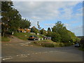
Road Junction in Ratley
This is where Old Rd, Town Hill and High St meet the minor road running south west towards Upton House. The houses on the left run along the east side of Town Hill.
Image: © Nigel Mykura
Taken: 14 Sep 2012
0.12 miles
2
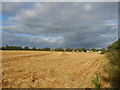
Stubble Field on Edge Hill
The top of edge hill is quite flat and has been used for farming for centuries. The top of the steep scarp slope is marked by the line of hills on the left. The houses on the northern edge of the village of Ratley can be seen on the right.
Image: © Nigel Mykura
Taken: 14 Sep 2012
0.13 miles
3
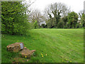
Ratley Element Trail: Fire
Fire is the third of the ancient elements to be celebrated in the Millennium sculpture trail. On the level part of the Lower Recreation Ground is the village's bonfire site. Nearby, beneath these stones, is a time capsule containing "a unique account of the life and history of Ratley at the dawn of the third millennium." It was interred on Thursday June 21st 2001 with greetings and good wishes to future generations.
Image: © Robin Stott
Taken: 25 Apr 2010
0.13 miles
4
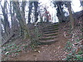
Jacob's Ladder meets the road on Edgehill
Image: © Liz Stone
Taken: 23 Feb 2012
0.15 miles
5
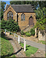
Ratley: former chapel
A tiny ironstone chapel on one of the steep lanes of a hilltop village.
Image: © John Sutton
Taken: 30 Aug 2013
0.16 miles
6
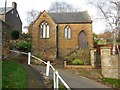
Ratley Former Wesleyan Chapel
Dating from 1865
Image: © Ian Rob
Taken: 22 Nov 2015
0.16 miles
7
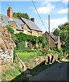
Ratley: cottages and former chapel on Chapel Lane
At the end of summer the gardens were less colourful than when Robin Stott was here in spring 2010: Image
Image: © John Sutton
Taken: 30 Aug 2013
0.16 miles
9
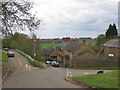
Junction of High Street and Chapel Lane
At the top of the old village. The lane on the right heads roughly southwest to Upton, passing to the south of Edgehill and the Millennium obelisk Image
Image: © Robin Stott
Taken: 25 Apr 2010
0.17 miles
10
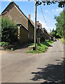
Ratley High Street
The steepness of the hill didn't seem to bother local lads on bikes.
Image: © John Sutton
Taken: 30 Aug 2013
0.17 miles