
IMAGES TAKEN NEAR TO
The Bourne, BANBURY, OX15 5PE
Introduction
This page details the photographs taken nearby to The Bourne, OX15 5PE by members of the Geograph project.
The Geograph project started in 2005 with the aim of publishing, organising and preserving representative images for every square kilometre of Great Britain, Ireland and the Isle of Man.

There are currently over 7.5m images from over14,400 individuals and you can help contribute to the project by visiting https://www.geograph.org.uk
Image Map
Images are licensed for reuse under creativecommons.org/licenses/by-sa/2.0
Notes
- Clicking on the map will re-center to the selected point.
- The higher the marker number, the further away the image location is from the centre of the postcode.
Image Listing (201 Images Found)
Images are licensed for reuse under creativecommons.org/licenses/by-sa/2.0
Image
Details
Distance
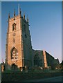
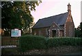
3
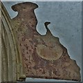
Hook Norton, St. Peter's Church: Fragment of medieval wall painting 6
Image: © Michael Garlick
Taken: 16 Jun 2017
0.04 miles
4
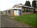
Hook Norton Telephone Exchange
Situated in Bourne Avenue OX15 5PG, this TE would appear to date from the late 1960s and has the code SMHN. It provides telephone and broadband services to approximately 1,229 residential and 97 non-residential premises in Hook Norton plus Great Rollright, Swerford and Wigginton nearby. The numbering ranges of this TE are (01608) 730xxx, 737xxx, the (01608) referring to the Chipping Norton group of thirteen TEs. A yellow grit salt bin can be seen outside this TE with a white BT warning notice above it.
Image: © David Hillas
Taken: 22 Oct 2022
0.04 miles
5
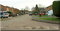
Rectory Road, Hook Norton
Seen from the junction with Bourne Lane.
Image: © Derek Harper
Taken: 10 Feb 2022
0.06 miles
6
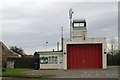
Hook Norton fire station
Hook Norton fire station, The Bourne, Hook Norton, Oxfordshire
Image: © Kevin Hale
Taken: 24 Nov 2007
0.08 miles
7
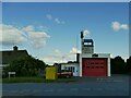
Hook Norton Community Fire Station
A small volunteer brigade.
Image: © Stephen Craven
Taken: 20 Sep 2021
0.08 miles
8
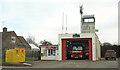
Hook Norton fire station
As shown at https://www.geograph.org.uk/gridref/SP3533?centi=SP355333 , but here the door is open.
Image: © Derek Harper
Taken: 10 Feb 2022
0.08 miles
9
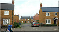
Goldings Road, Hook Norton
A second junction from Bourne Lane into the new housing development; see also Image
Image: © Derek Harper
Taken: 10 Feb 2022
0.08 miles
10
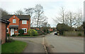
The Bourne, Hook Norton
Passing the junction with The Shearings.
Image: © Derek Harper
Taken: 10 Feb 2022
0.09 miles