
IMAGES TAKEN NEAR TO
Scotland End, BANBURY, OX15 5NR
Introduction
This page details the photographs taken nearby to Scotland End, OX15 5NR by members of the Geograph project.
The Geograph project started in 2005 with the aim of publishing, organising and preserving representative images for every square kilometre of Great Britain, Ireland and the Isle of Man.

There are currently over 7.5m images from over14,400 individuals and you can help contribute to the project by visiting https://www.geograph.org.uk
Image Map
Images are licensed for reuse under creativecommons.org/licenses/by-sa/2.0
Notes
- Clicking on the map will re-center to the selected point.
- The higher the marker number, the further away the image location is from the centre of the postcode.
Image Listing (298 Images Found)
Images are licensed for reuse under creativecommons.org/licenses/by-sa/2.0
Image
Details
Distance
1

Houses, Hook Norton
Seen from footpath 253 16/10 which bends sharply left here. The houses ahead overlook Scotland End.
Image: © Derek Harper
Taken: 10 Feb 2022
0.02 miles
2
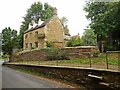
Hook Norton-Sunnybank Farmhouse
At Scotland End.
Image: © Ian Rob
Taken: 14 Aug 2018
0.03 miles
3

Old School End, Hook Norton
Reached along footpath 253 16/10 from the scene in Image
Image: © Derek Harper
Taken: 10 Feb 2022
0.03 miles
4
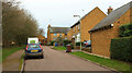
Old School End, Hook Norton
Looking in the opposite direction from Image
Image: © Derek Harper
Taken: 10 Feb 2022
0.03 miles
5

Netting Street
This is the main exit from the village to the west, looking towards the village centre.
Image: © Alan Murray-Rust
Taken: 22 Feb 2010
0.04 miles
6
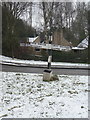
Signpost at Scotland End
A traditional fingerpost at the western end of the village. The missing finger pointing towards the camera has been replaced by a modern version on a separate post http://www.geograph.org.uk/photo/1733393 .
Image: © Alan Murray-Rust
Taken: 22 Feb 2010
0.06 miles
7
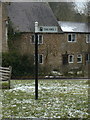
Fingerpost at Scotland End
Unusually pointing the way to the nearest filling station, rather than to a specific town or village. At least it is in a traditional style.
Image: © Alan Murray-Rust
Taken: 22 Feb 2010
0.06 miles
8
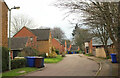
Old School End, Hook Norton
Further along the cul-de-sac seen in Image Footpath 253 16/10 is mapped as following the road.
Image: © Derek Harper
Taken: 10 Feb 2022
0.06 miles
9
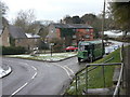
Scotland End
A small triangular green alongside the road to Chipping Norton, faced by the Pear Tree Inn. The old bus has brought a party of visitors to the Brewery, stopping for lunch at the Inn.
Image: © Alan Murray-Rust
Taken: 22 Feb 2010
0.06 miles
10
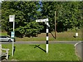
Signpost and bus stop in Hook Norton
Buses leave hourly from here to Banbury.
Image: © Stephen Craven
Taken: 20 Sep 2021
0.06 miles