
IMAGES TAKEN NEAR TO
Netting Street, BANBURY, OX15 5NP
Introduction
This page details the photographs taken nearby to Netting Street, OX15 5NP by members of the Geograph project.
The Geograph project started in 2005 with the aim of publishing, organising and preserving representative images for every square kilometre of Great Britain, Ireland and the Isle of Man.

There are currently over 7.5m images from over14,400 individuals and you can help contribute to the project by visiting https://www.geograph.org.uk
Image Map
Images are licensed for reuse under creativecommons.org/licenses/by-sa/2.0
Notes
- Clicking on the map will re-center to the selected point.
- The higher the marker number, the further away the image location is from the centre of the postcode.
Image Listing (239 Images Found)
Images are licensed for reuse under creativecommons.org/licenses/by-sa/2.0
Image
Details
Distance
1
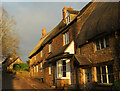
Cottages on Netting Street, Hook Norton
Nearly the same view as Image, over ten years on, taken a few metres further west. The three cottages are listed; nearest is Moonbeam Thatch https://historicengland.org.uk/listing/the-list/list-entry/1369865?section=official-listing , then The Old Sweet Shop https://historicengland.org.uk/listing/the-list/list-entry/1046256?section=official-listing , the unthatched one of the three and the holiday cottage, and then Petra https://historicengland.org.uk/listing/the-list/list-entry/1198756?section=official-listing .
Image: © Derek Harper
Taken: 9 Feb 2022
0.01 miles
2

Netting Street, Hook Norton
A wider view than Image], with cottages on the other side of the street.
Image: © Derek Harper
Taken: 9 Feb 2022
0.01 miles
3
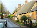
Cottages on Netting Street
A holiday cottage nestles in the row in the centre of the shot.
According to the information pack, Netting refers to Hook Norton's past cottage industry of knitting.
Image: © Jonathan Billinger
Taken: 26 Nov 2011
0.01 miles
4

St. Valentines, Netting Street
17th century house in coursed rubble ironstone with thatched roof. Listed Grade II.
Image: © Alan Murray-Rust
Taken: 22 Feb 2010
0.01 miles
5

Petra, Netting Street
Dating from the 17th century, with the further part being in a striking banded mix of ironstone and limestone. Listed Grade II.
Image: © Alan Murray-Rust
Taken: 22 Feb 2010
0.01 miles
6
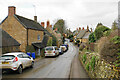
Netting Street
The main road in the village, but it is narrow. It has a selection of listed buildings.
Image: © Bill Boaden
Taken: 27 Jan 2022
0.02 miles
7
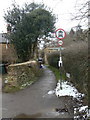
Watery Lane
Marked on the OS map as a road, rather than a byway, footpath or bridleway, the signs indicate that a horse and cart would be the only sort of vehicle permitted.
Image: © Alan Murray-Rust
Taken: 22 Feb 2010
0.02 miles
8
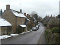
Netting Street
Looking west from near the Baptist Church.
Image: © Alan Murray-Rust
Taken: 22 Feb 2010
0.02 miles
9

Hook Norton Manor
Although dated 1636, the house has more the appearance of the Elizabethan period with mullioned windows and gables. Listed Grade II.
Image: © Alan Murray-Rust
Taken: 22 Feb 2010
0.03 miles
10
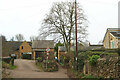
Watery Lane, Hook Norton
The lane becomes too narrow for vehicles as it approaches Netting Street, and the left turn is a footpath - 253 17/10.
Image: © Derek Harper
Taken: 10 Feb 2022
0.03 miles