
IMAGES TAKEN NEAR TO
Hook Norton, BANBURY, OX15 5DB
Introduction
This page details the photographs taken nearby to OX15 5DB by members of the Geograph project.
The Geograph project started in 2005 with the aim of publishing, organising and preserving representative images for every square kilometre of Great Britain, Ireland and the Isle of Man.

There are currently over 7.5m images from over14,400 individuals and you can help contribute to the project by visiting https://www.geograph.org.uk
Image Map
Images are licensed for reuse under creativecommons.org/licenses/by-sa/2.0
Notes
- Clicking on the map will re-center to the selected point.
- The higher the marker number, the further away the image location is from the centre of the postcode.
Image Listing (12 Images Found)
Images are licensed for reuse under creativecommons.org/licenses/by-sa/2.0
Image
Details
Distance
2
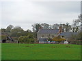
Six Ash Farm
The farm is seen, across the fields, from the footpath.
Image: © Michael Dibb
Taken: 12 Nov 2011
0.16 miles
3
![Fodge Farm [5]](https://s3.geograph.org.uk/geophotos/02/77/83/2778343_41d9a773_120x120.jpg)
Fodge Farm [5]
The farm is seen, across the fields, from the minor road.
Image: © Michael Dibb
Taken: 12 Nov 2011
0.19 miles

5
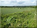
Farmland near Fodge Farm
Arable land to the north of Fodge Farm near Sibford Ferris.
Image: © Philip Halling
Taken: 7 Jun 2017
0.21 miles
6
![Fodge Farm [1]](https://s1.geograph.org.uk/geophotos/02/77/80/2778069_f049ccef_120x120.jpg)
Fodge Farm [1]
The farm buildings are seen, across the field, from the footpath.
Image: © Michael Dibb
Taken: 12 Nov 2011
0.21 miles
7
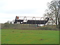
The roof is almost gone
This elderly dutch barn, part of Six Ash Farm, has lost most of its roof. Seen from the footpath.
Image: © Michael Dibb
Taken: 12 Nov 2011
0.21 miles

10

A spring or a very small lake? On a path near the Firs garage
Image: © Dave Favis-Mortlock
Taken: 20 May 2012
0.25 miles