
IMAGES TAKEN NEAR TO
Sibford Ferris, BANBURY, OX15 5AA
Introduction
This page details the photographs taken nearby to OX15 5AA by members of the Geograph project.
The Geograph project started in 2005 with the aim of publishing, organising and preserving representative images for every square kilometre of Great Britain, Ireland and the Isle of Man.

There are currently over 7.5m images from over14,400 individuals and you can help contribute to the project by visiting https://www.geograph.org.uk
Image Map
Images are licensed for reuse under creativecommons.org/licenses/by-sa/2.0
Notes
- Clicking on the map will re-center to the selected point.
- The higher the marker number, the further away the image location is from the centre of the postcode.
Image Listing (7 Images Found)
Images are licensed for reuse under creativecommons.org/licenses/by-sa/2.0
Image
Details
Distance

2
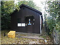
Swalcliffe Telephone Exchange
Situated in Grange Lane OX15 5EY, this dark wooden TE is a common sight in rural areas and would have replaced during the 1970s I believe the smaller brick TE in the same locality. This TE has the code SMSWF and provides telephone and broadband services to approximately 921 residential and 70 non-residential premises in Swalcliffe plus Burdrop, Epwell, Sibford Ferris, Sibford Gower, Shutford and Upper Tadmarton nearby. The numbering ranges of this TE are (01295) 780xxx, 781xxx, 788xxx, the (01295) referring to the Banbury group of thirteen TEs. A yellow grit salt bin can be seen in front of this TE.
Image: © David Hillas
Taken: 22 Oct 2022
0.16 miles
5
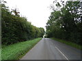
B4035 crossroads south of Tyne Hill Farm
Image: © Stuart Logan
Taken: 13 Apr 2014
0.20 miles
6

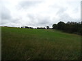
View to Burdrop
View to the village of Burdrop from a crossroads at Sibford Elm. Brailes Hill with its clump of trees on the summit can be seen in the distance.
Image: © Philip Halling
Taken: 12 Jul 2012
0.20 miles
7

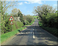
Traditional Oxfordshire roadsign
Traditional Oxfordshire roadsign on the B4035 to the west of Swalcliffe.
Image: © Philip Halling
Taken: 12 Jul 2012
0.25 miles