IMAGES TAKEN NEAR TO
Chipperfield Park Road, BANBURY, OX15 4NX

Introduction

This page details the photographs taken nearby to Chipperfield Park Road, OX15 4NX by members of the Geograph project.

The Geograph project started in 2005 with the aim of publishing, organising and preserving representative images for every square kilometre of Great Britain, Ireland and the Isle of Man.

There are currently over 7.5m images from over14,400 individuals and you can help contribute to the project by visiting https://www.geograph.org.uk

Image Map


Images are licensed for reuse under creativecommons.org/licenses/by-sa/2.0
Notes
  • Clicking on the map will re-center to the selected point.
  • The higher the marker number, the further away the image location is from the centre of the postcode.

Image Listing (9 Images Found)

Images are licensed for reuse under creativecommons.org/licenses/by-sa/2.0
Image
Details
Distance
1
Ditch beside Banbury Road (A361)
Image: © Roger Templeman Taken: 27 Oct 2017
0.09 miles
2
Warriner School, Bloxham
Image: © David Stowell Taken: 10 Sep 2006
0.09 miles
3
Junction of Ells Lane and Banbury Road (A361)
There is an OS benchmark Image on the culvert top at the near end the roadside ditch beyond the metal drain cover, left of lane name sign
Image: © Roger Templeman Taken: 27 Oct 2017
0.13 miles
4
Benchmark on culvert at junction of Lees Lane / Banbury Road junction
Ordnance Survey rivet benchmark described on the Bench Mark Database at http://www.bench-marks.org.uk/bm90076
Image: © Roger Templeman Taken: 27 Oct 2017
0.14 miles
5
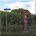
National Cycle Network route 5 marker
This colourful marker is just outside the Warriner School side gates.
Image: © Duncan Lilly Taken: 31 May 2007
0.15 miles
6
New development, Bloxham
Construction of a new housing estate is underway on the northern edge of the village beside the Banbury Road.
Image: © David Stowell Taken: 10 Sep 2006
0.17 miles
7
Milestone on NW side of A361
Image: © Roger Templeman Taken: 27 Oct 2017
0.17 miles
8
Old Milestone by the A361, Banbury Road, Bloxham
Chipping Norton iron plate by the A361, in parish of Bloxham (Cherwell District), Banbury Road; by "Dursley", 200m North West of Bloxham School, near bus stop, backing onto wooden fence covered in ivy, in front of grass and the footpath. Inscription reads:- Chipping Norton 10 Banbury 2 Miles Grade II listed. List Entry Number: 1046212 https://historicengland.org.uk/listing/the-list/list-entry/1046212 Surveyed Milestone Society National ID: OX_bfba21
Image: © Milestone Society Taken: Unknown
0.18 miles
9
Milestone on the NW side of Banbury Road, outside 'Dursley'
A closeup of the milestone is at Image
Image: © Roger Templeman Taken: 27 Oct 2017
0.18 miles