
IMAGES TAKEN NEAR TO
High Street, BANBURY, OX15 4LU
Introduction
This page details the photographs taken nearby to High Street, OX15 4LU by members of the Geograph project.
The Geograph project started in 2005 with the aim of publishing, organising and preserving representative images for every square kilometre of Great Britain, Ireland and the Isle of Man.

There are currently over 7.5m images from over14,400 individuals and you can help contribute to the project by visiting https://www.geograph.org.uk
Image Map
Images are licensed for reuse under creativecommons.org/licenses/by-sa/2.0
Notes
- Clicking on the map will re-center to the selected point.
- The higher the marker number, the further away the image location is from the centre of the postcode.
Image Listing (159 Images Found)
Images are licensed for reuse under creativecommons.org/licenses/by-sa/2.0
Image
Details
Distance
1
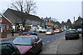
High Street, Bloxham
There are frequent bottlenecks on the A361 through the village, not helped by cars parking on the road outside the Co-op. A view at dusk.
Image: © Bill Boaden
Taken: 24 Jan 2022
0.01 miles
2
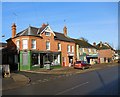
Bloxham High Street
Shop on the corner of Workhouse Lane.
Image: © Ian Rob
Taken: 24 Jan 2015
0.02 miles
3
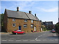
Bloxham
These houses on the corner of High Street and Chapel Street are typical of much of this lovely ironstone village and are right on the SE corner of the square.
Image: © David Stowell
Taken: 10 Sep 2006
0.03 miles
4
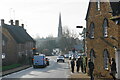
High Street, Bloxham
The A361 passing through Bloxham can sometimes be a bit of a bottleneck. Bloxham School owns quite a lot of the buildings in the village.
Image: © Bill Boaden
Taken: 26 Jan 2022
0.03 miles
5
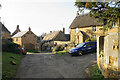
Rosebank, Bloxham
A narrow road in an older quarter of Bloxham.
Image: © Bill Boaden
Taken: 26 Jan 2022
0.06 miles
6
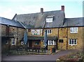
Bloxham - Elephant & Castle Yard
Courtyard of this historic Oxfordshire coaching inn, built from local stone.
Image: © Colin Smith
Taken: 30 Dec 2014
0.08 miles
7
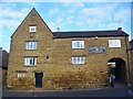
Bloxham - The Elephant & Castle
Historic stone-built coaching inn, now in the Hook Norton Ales stable.
Image: © Colin Smith
Taken: 30 Dec 2014
0.08 miles
9
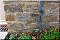
Benchmark on Bloxham School building, Courtington Lane
Ordnance Survey cut mark benchmark described on the Bench Mark Database at http://www.bench-marks.org.uk/bm90670
Image: © Roger Templeman
Taken: 27 Oct 2017
0.09 miles
10
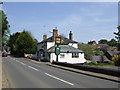
The Red Lion, Bloxham
Having lost its "pink look" becoming part of the expanding Fuller's empire.
Image: © al partington
Taken: 11 May 2006
0.10 miles