
IMAGES TAKEN NEAR TO
Hempton, BANBURY, OX15 0QL
Introduction
This page details the photographs taken nearby to OX15 0QL by members of the Geograph project.
The Geograph project started in 2005 with the aim of publishing, organising and preserving representative images for every square kilometre of Great Britain, Ireland and the Isle of Man.

There are currently over 7.5m images from over14,400 individuals and you can help contribute to the project by visiting https://www.geograph.org.uk
Image Map
Images are licensed for reuse under creativecommons.org/licenses/by-sa/2.0
Notes
- Clicking on the map will re-center to the selected point.
- The higher the marker number, the further away the image location is from the centre of the postcode.
Image Listing (3 Images Found)
Images are licensed for reuse under creativecommons.org/licenses/by-sa/2.0
Image
Details
Distance
1
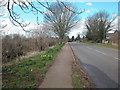
Hempton
Approach to the village from Deddington. The village stands on a ridge overlooking the River Swere valley.
Image: © Dennis Turner
Taken: 8 Apr 2006
0.04 miles
2
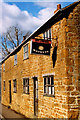
Watneys Off Licence
Here's a name from the past. Watneys. One time mass producer of notoriously lacklustre beer.
Beer drinkers of a certain age will remember Watneys' market share never recovering after being lampooned as "Grotneys" by the Campaign for Real Ale.
This old sign still hangs outside what presumably was once a shop on a very narrow section of the main road in Hempton.
Image: © Des Blenkinsopp
Taken: 20 Feb 2008
0.17 miles
3
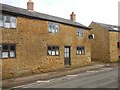
Hempton Cottages
What appears to have been an Off Licence.
Image: © Ian Rob
Taken: 25 Mar 2018
0.17 miles