
IMAGES TAKEN NEAR TO
Vicarage Road, OXFORD, OX1 4RD
Introduction
This page details the photographs taken nearby to Vicarage Road, OX1 4RD by members of the Geograph project.
The Geograph project started in 2005 with the aim of publishing, organising and preserving representative images for every square kilometre of Great Britain, Ireland and the Isle of Man.

There are currently over 7.5m images from over14,400 individuals and you can help contribute to the project by visiting https://www.geograph.org.uk
Image Map
Images are licensed for reuse under creativecommons.org/licenses/by-sa/2.0
Notes
- Clicking on the map will re-center to the selected point.
- The higher the marker number, the further away the image location is from the centre of the postcode.
Image Listing (114 Images Found)
Images are licensed for reuse under creativecommons.org/licenses/by-sa/2.0
Image
Details
Distance
1

Vicarage Lane, New Hinksey
This is the oldest part of New Hinksey with a tight cluster of streets around a primary school and the church of St John the Evangelist (whose wall can be seen in this view). Oddly, Vicarage Lane leads off Vicarage Road, but the latter was called Church Street until 1955.
Image: © Stephen McKay
Taken: 2 Nov 2021
0.00 miles
2
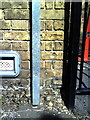
Benchmark on New Hinksey CE Primary School, Vicarage Lane
Ordnance Survey cut mark benchmark described on the Bench Mark Database at http://www.bench-marks.org.uk/bm24303.
Image: © Roger Templeman
Taken: 2 Sep 2010
0.01 miles
3
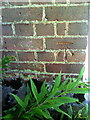
Benchmark on St John the Evangelist's Church
Ordnance Survey cut mark benchmark described on the Bench Mark Database at http://www.bench-marks.org.uk/bm24302.
Image: © Roger Templeman
Taken: 2 Sep 2010
0.02 miles
4

Vicarage Road, New Hinksey
The vicarage that gives this road its name belongs to the church of St John the Evangelist which is out of shot to the right. The road was in fact called Church Street until 1955. The school entrance markings refer to New Hinksey Primary School which is out of shot to the left.
Image: © Stephen McKay
Taken: 2 Nov 2021
0.02 miles
5
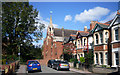
St. John The Evangelist, New Hinksey
New Hinksey is a Victorian suburb of a dozen or so blocks built to the east of South Hinksey village alongside the Abingdon Road.
This church dates from 1900. Its predecessor only lasted 30 years.
http://en.wikipedia.org/wiki/New_Hinksey
Image: © Des Blenkinsopp
Taken: 14 Sep 2011
0.02 miles
6
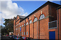
South Oxford Community Centre
This Victorian school building in Lake Street is now being used as a community centre.
http://www.southoxford.org/
The small building beyond is a doctors' surgery.
Image: © Des Blenkinsopp
Taken: 14 Sep 2011
0.02 miles
7
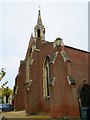
St John the Evangelist Church on Wytham Street
Image: © Steve Daniels
Taken: 21 Nov 2017
0.03 miles
8

Cycle track and footpath by Hinksey Lake
Image: © Steve Daniels
Taken: 21 Nov 2017
0.03 miles
9
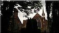
St John the Evangelist and vicarage, New Hinksey
The church was built c. 1900 to designs by William Bucknall and Ninian Comper, replacing one of 1870 by the Oxford architect E G Bruton. The vicarage of 1887 is by H W Moore who designed much of the later Victorian housing of North Oxford.
Image: © Chris Brown
Taken: 13 Jul 2017
0.03 miles
