IMAGES TAKEN NEAR TO
Edith Road, OXFORD, OX1 4QA
Introduction
This page details the photographs taken nearby to Edith Road, OX1 4QA by members of the Geograph project.
The Geograph project started in 2005 with the aim of publishing, organising and preserving representative images for every square kilometre of Great Britain, Ireland and the Isle of Man.

There are currently over 7.5m images from over14,400 individuals and you can help contribute to the project by visiting https://www.geograph.org.uk
Image Map
Images are licensed for reuse under creativecommons.org/licenses/by-sa/2.0
Notes
- Clicking on the map will re-center to the selected point.
- The higher the marker number, the further away the image location is from the centre of the postcode.
Image Listing (123 Images Found)
Images are licensed for reuse under creativecommons.org/licenses/by-sa/2.0
Image
Details
Distance
2
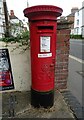
George V postbox on Abingdon Road, Oxford
Postbox No. OX1 94.
Image: © JThomas
Taken: 26 Jul 2022
0.07 miles
3
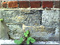
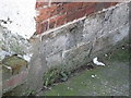
Benchmark on #83 Abingdon Road
Ordnance Survey cut mark benchmark described on the Bench Mark Database at http://www.bench-marks.org.uk/bm24306.
Image: © Roger Templeman
Taken: 15 Sep 2010
0.07 miles
5
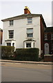
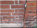
#81 and #83 Abingdon Road
There is an OS benchmark Image on the side of the right hand house in a stone course above the path leading to the house's front door.
Image: © Roger Templeman
Taken: 28 Feb 2017
0.07 miles
7
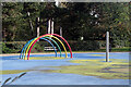
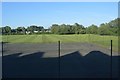
Hinksey Splash
A feature of Hinksey Park is this splash play area that 'boasts a colourful misty rainbow, shooting water sprays and water fountains as well as grassed areas and picnic benches'. Sadly on this November day it was not operational.
Image: © Stephen McKay
Taken: 2 Nov 2021
0.08 miles
8
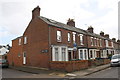
Junction of Newton Road and Marlborough Road
There is an OS benchmark Image in the bricks at the junction of the corner house and its front side wall, below the Newton Road sign
Image: © Roger Templeman
Taken: 22 Feb 2014
0.08 miles
9
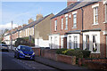
Marlborough Road, Grandpont
This street was developed in the early 1880s. Its name comes from the Duke of Marlborough who was a major landowner in the area. Newton Road leads off to the right.
Image: © Stephen McKay
Taken: 2 Nov 2021
0.08 miles