
IMAGES TAKEN NEAR TO
Abingdon Road, OXFORD, OX1 4LE
Introduction
This page details the photographs taken nearby to Abingdon Road, OX1 4LE by members of the Geograph project.
The Geograph project started in 2005 with the aim of publishing, organising and preserving representative images for every square kilometre of Great Britain, Ireland and the Isle of Man.

There are currently over 7.5m images from over14,400 individuals and you can help contribute to the project by visiting https://www.geograph.org.uk
Image Map
Images are licensed for reuse under creativecommons.org/licenses/by-sa/2.0
Notes
- Clicking on the map will re-center to the selected point.
- The higher the marker number, the further away the image location is from the centre of the postcode.
Image Listing (407 Images Found)
Images are licensed for reuse under creativecommons.org/licenses/by-sa/2.0
Image
Details
Distance
1
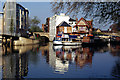
River Isis (Thames), Oxford
Showing the river just downstream from Folly Bridge, above the confluence with the Cherwell.
Image: © Stephen McKay
Taken: 4 May 2006
0.02 miles
2
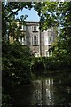
Oxford: building at Folly Bridge
This eighteenth century house stands on the Abingdon Road just south of Folly Bridge, straddling a small backwater of the Thames. The towpath following the main river crosses the bottom end of the backwater on a footbridge from which the photograph is taken: the road frontage is on the far side of the house.
Image: © Christopher Hilton
Taken: 23 Jun 2009
0.02 miles
3
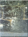
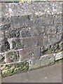
Benchmark on wall outside #2 Abingdon Road
Ordnance Survey cut mark benchmark described on the Bench Mark Database at http://www.bench-marks.org.uk/bm24309.
Image: © Roger Templeman
Taken: 15 Sep 2010
0.02 miles
4
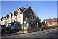
Junction of Western Road and Abingdon Road
There is an OS benchmark Image on the bridge parapet near the right hand side of the image
Image: © Roger Templeman
Taken: 15 Nov 2013
0.02 miles
6

Church of Holy Rood, Abingdon Road, Oxford
The church was built in 1961. It is in the parish of North Hinksey which is the northernmost parish of the Roman Catholic Diocese of Portsmouth. The architect was Gilbert Flavel. It is grade II listed.
Comprehensive histories of the church are given in https://hinkseyparish.org/our-churches/holy-rood/and in its English Heritage listing at https://historicengland.org.uk/listing/the-list/list-entry/1466650?section=official-list-entry .
Image: © Rod Grealish
Taken: 9 Apr 2026
0.04 miles
10

Sailing barge with leeboard, on The Thames at Oxford
Barge with leeboard, moored on the Thames or Isis opposite Christ Church Meadow. This is probably as far up the river as broad beamed barges can go. If anyone can identify the type of barge please send a message. I looked at "A barge spotter's guide" http://members.lycos.co.uk/celticfringe/abarge.htm but I may not be showing enough detail for identification.
[Addition in October 2009]A site user has provided extra information:
Barge appears to be a Dutch sailing barge very similar to our own Thames barges but generally of a more rounded shape. (Many are Tjalk barges Tjalk roughly translating as "Barrel").
Dutch barges are (depending on which historical sources you go by) Direct cousins of our own breed.
Image: © David Hawgood
Taken: 23 Jun 2006
0.05 miles