IMAGES TAKEN NEAR TO
Ferguson Place, ABINGDON, OX14 3YF
Introduction
This page details the photographs taken nearby to Ferguson Place, OX14 3YF by members of the Geograph project.
The Geograph project started in 2005 with the aim of publishing, organising and preserving representative images for every square kilometre of Great Britain, Ireland and the Isle of Man.

There are currently over 7.5m images from over14,400 individuals and you can help contribute to the project by visiting https://www.geograph.org.uk
Image Map
Images are licensed for reuse under creativecommons.org/licenses/by-sa/2.0
Notes
- Clicking on the map will re-center to the selected point.
- The higher the marker number, the further away the image location is from the centre of the postcode.
Image Listing (4 Images Found)
Images are licensed for reuse under creativecommons.org/licenses/by-sa/2.0
Image
Details
Distance
2
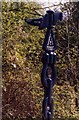
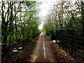
Along the Hanson Way 1
One of the distance markers along National Cycle Network route 5
Image: © Claire Ward
Taken: 24 Apr 2004
0.22 miles
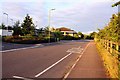
4
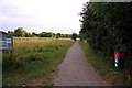
The National Cycle Network by Barton Fields
Image: © Steve Daniels
Taken: 9 Jul 2009
0.24 miles