
IMAGES TAKEN NEAR TO
Wheatcroft Close, ABINGDON, OX14 2BE
Introduction
This page details the photographs taken nearby to Wheatcroft Close, OX14 2BE by members of the Geograph project.
The Geograph project started in 2005 with the aim of publishing, organising and preserving representative images for every square kilometre of Great Britain, Ireland and the Isle of Man.

There are currently over 7.5m images from over14,400 individuals and you can help contribute to the project by visiting https://www.geograph.org.uk
Image Map
Images are licensed for reuse under creativecommons.org/licenses/by-sa/2.0
Notes
- Clicking on the map will re-center to the selected point.
- The higher the marker number, the further away the image location is from the centre of the postcode.
Image Listing (12 Images Found)
Images are licensed for reuse under creativecommons.org/licenses/by-sa/2.0
Image
Details
Distance
3
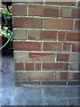
Benchmark on #103 South Avenue
Ordnance Survey cut mark benchmark described on the Bench Mark Database at http://www.bench-marks.org.uk/bm23436.
Image: © Roger Templeman
Taken: 17 Sep 2010
0.12 miles
4
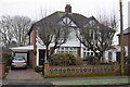
#103 and #105 South Avenue
There is an OS benchmark Image on the back corner of the left hand side house under its car port.
Image: © Roger Templeman
Taken: 16 Jan 2013
0.12 miles
5
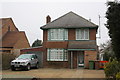
#184 Oxford Road
There is an OS benchmark Image on the right hand side of the house, just past the brown wheelie bin
Image: © Roger Templeman
Taken: 16 Jan 2013
0.17 miles
6
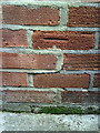
Benchmark on side of #184 Oxford Road
Ordnance Survey cut mark benchmark described on the Bench Mark Database at http://www.bench-marks.org.uk/bm23339
Image: © Roger Templeman
Taken: 17 Sep 2010
0.18 miles
7
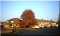
The Grove, North Abingdon
An Autumn evening in suburban Abingdon on the corner of Appleford Drive and The Grove.
Image: © Des Blenkinsopp
Taken: 15 Nov 2011
0.18 miles
8
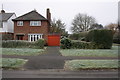
#65 Sellwood Road
There is an OS benchmark Image on the angle of the wall to the right of the house. The mark is now hidden by the creeper growing on the wall.
Image: © Roger Templeman
Taken: 16 Jan 2013
0.19 miles
9
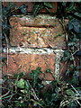
Benchmark on wall at junction of Sellwood Road and Terrington Close
Ordnance Survey cut mark benchmark described on the Bench Mark Database at http://www.bench-marks.org.uk/bm22182
Image: © Roger Templeman
Taken: 17 Sep 2010
0.20 miles
10
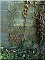
Benchmark on garage beside #11 Appleford Drive
Ordnance Survey cut mark benchmark described on the Bench Mark Database at http://www.bench-marks.org.uk/bm23146
Image: © Roger Templeman
Taken: 17 Sep 2010
0.21 miles