IMAGES TAKEN NEAR TO
Hemmings Lane, OX14 1SA
Introduction
This page details the photographs taken nearby to Hemmings Lane, OX14 1SA by members of the Geograph project.
The Geograph project started in 2005 with the aim of publishing, organising and preserving representative images for every square kilometre of Great Britain, Ireland and the Isle of Man.

There are currently over 7.5m images from over14,400 individuals and you can help contribute to the project by visiting https://www.geograph.org.uk
Image Map (10 Images)


Getting Data...Please wait
Leaflet Map data © OpenStreetMap
Images are licensed for reuse under creativecommons.org/licenses/by-sa/2.0
Notes
- Clicking on the map will re-center to the selected point.
- The higher the marker number, the further away the image location is from the centre of the postcode.
Image Listing (10 Images Found)
Images are licensed for reuse under creativecommons.org/licenses/by-sa/2.0
Image
Details
Distance
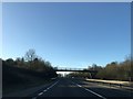
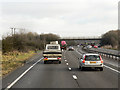
1
The A34, Sunningwell
Viewed from a bridge on a bridleway with the downs hazily in the background.
Image: © Andrew Smith
Taken: 19 Oct 2014
0.12 miles
2
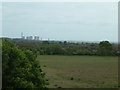
The View from the footbridge over the A34
Looking across the Thames Valley, dominating the skyline is Didcot Power Station but beyond is the ancient Ridgeway.
Image: © Claire Ward
Taken: 14 May 2005
0.15 miles
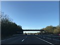
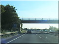
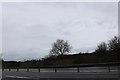
3
Layby and Bridge on the A34 south of Sunningwell
Image: © David Dixon
Taken: 21 Dec 2012
0.16 miles
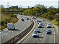
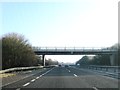
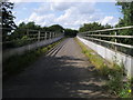
5
Footbridge over the A34 near Sunningwell
Image: © Steve Daniels
Taken: 2 May 2009
0.19 miles
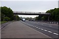
8
Oxford Green Belt Way
The Oxford Green Belt Way crossing the A34 heading to Sunningwell
Image: © Shaun Ferguson
Taken: 14 Aug 2012
0.20 miles