
IMAGES TAKEN NEAR TO
Larkhill Road, ABINGDON, OX14 1BJ
Introduction
This page details the photographs taken nearby to Larkhill Road, OX14 1BJ by members of the Geograph project.
The Geograph project started in 2005 with the aim of publishing, organising and preserving representative images for every square kilometre of Great Britain, Ireland and the Isle of Man.

There are currently over 7.5m images from over14,400 individuals and you can help contribute to the project by visiting https://www.geograph.org.uk
Image Map
Images are licensed for reuse under creativecommons.org/licenses/by-sa/2.0
Notes
- Clicking on the map will re-center to the selected point.
- The higher the marker number, the further away the image location is from the centre of the postcode.
Image Listing (22 Images Found)
Images are licensed for reuse under creativecommons.org/licenses/by-sa/2.0
Image
Details
Distance
1
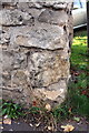
Remains of old benchmark at north end of Park Crescent
Ordnance Survey cut mark benchmark described on the Bench Mark Database at http://www.bench-marks.org.uk/bm38169
Image: © Roger Templeman
Taken: 3 Oct 2011
0.14 miles
2
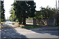
View across Faringdon Road down Park Crescent
The monument at the end of Park Crescent is in Albert Park.
Image: © Roger Templeman
Taken: 3 Oct 2011
0.14 miles
3
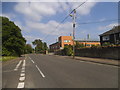
Faringdon Road, Abingdon
Looking towards Abingdon School's recently renovated science centre.
Image: © David Howard
Taken: 29 May 2016
0.15 miles
4
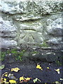
Benchmark on wall on south side of Faringdon Road
Ordnance Survey cut mark benchmark described on the Bench Mark Database at http://www.bench-marks.org.uk/bm23144
Image: © Roger Templeman
Taken: 2 Oct 2010
0.17 miles
5
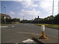
Faringdon Road at the junction of Spring Road
Image: © David Howard
Taken: 29 May 2016
0.17 miles
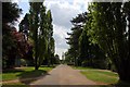
7
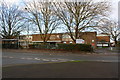
John Mason School, Wootton Road
There is an OS Image left of the lamppost, right of the bus shelter
Image: © Roger Templeman
Taken: 12 Jan 2016
0.18 miles

9
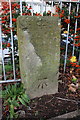
Benchmark on boundary stone, Wootton Road
Ordnance Survey cut mark benchmark described on the Bench Mark Database at http://www.bench-marks.org.uk/bm63321
The stone has Milestone Society National ID: BE_ABI05ZZ
Image: © Roger Templeman
Taken: 12 Jan 2016
0.19 miles
10
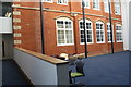
School of St Helen and St Katharine
Formerly the building shown was an external part of the school, but the school has been extended and the area in front of it now used as a lounge
Image: © Roger Templeman
Taken: 8 Apr 2015
0.22 miles