IMAGES TAKEN NEAR TO
Home Close, ABINGDON, OX13 6DD
Introduction
This page details the photographs taken nearby to Home Close, OX13 6DD by members of the Geograph project.
The Geograph project started in 2005 with the aim of publishing, organising and preserving representative images for every square kilometre of Great Britain, Ireland and the Isle of Man.

There are currently over 7.5m images from over14,400 individuals and you can help contribute to the project by visiting https://www.geograph.org.uk
Image Map (Loading...)


Getting Data...Please wait
Leaflet Map data © OpenStreetMap
Images are licensed for reuse under creativecommons.org/licenses/by-sa/2.0
Notes
- Clicking on the map will re-center to the selected point.
- The higher the marker number, the further away the image location is from the centre of the postcode.
Image Listing (25 Images Found)
Images are licensed for reuse under creativecommons.org/licenses/by-sa/2.0
Image
Details
Distance
1
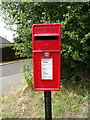
Elizabeth II postbox on Lamborough Hill, Wootton
Postbox No. OX13 1027.
See Image] for context.
Image: © JThomas
Taken: 15 Jul 2019
0.07 miles
3

Bungalow on Lamborough Hill, Wootton
Showing position of Postbox No. OX13 1027.
See Image] for postbox.
Image: © JThomas
Taken: 15 Jul 2019
0.08 miles
4
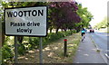
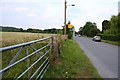
Lamborough Hill in the village of Wootton
Image: © Mat Fascione
Taken: 15 Jun 2015
0.08 miles
7
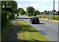
Speed camera on Lamborough Hill
In the village of Wootton.
Image: © Mat Fascione
Taken: 15 Jun 2015
0.15 miles
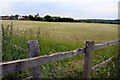
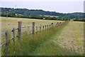
8
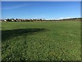
Path heading towards Manor Farm
Path off Lamborough Hill heading towards Manor Farm
Image: © Shaun Ferguson
Taken: 25 Oct 2017
0.15 miles
10
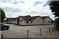
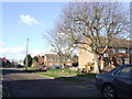
The Wootton and Dry Sandford Community Centre
Image: © JThomas
Taken: 15 Jul 2019
0.17 miles