
IMAGES TAKEN NEAR TO
Stonebridge Road, ABINGDON, OX13 6AS
Introduction
This page details the photographs taken nearby to Stonebridge Road, OX13 6AS by members of the Geograph project.
The Geograph project started in 2005 with the aim of publishing, organising and preserving representative images for every square kilometre of Great Britain, Ireland and the Isle of Man.

There are currently over 7.5m images from over14,400 individuals and you can help contribute to the project by visiting https://www.geograph.org.uk
Image Map
Images are licensed for reuse under creativecommons.org/licenses/by-sa/2.0
Notes
- Clicking on the map will re-center to the selected point.
- The higher the marker number, the further away the image location is from the centre of the postcode.
Image Listing (41 Images Found)
Images are licensed for reuse under creativecommons.org/licenses/by-sa/2.0
Image
Details
Distance

5
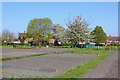
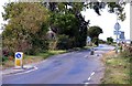
Steventon Allotments
Allotments in Steventon.
Image: © Wayland Smith
Taken: 9 Apr 2017
0.15 miles
7
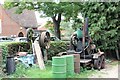
Stationary engines in the garden
Some old stationary engines in the front gardens of one of the houses along St Michaels way in Steventon.
Image: © Bill Nicholls
Taken: 7 Sep 2011
0.18 miles
8
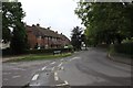
St Michaels Way
St Michaels way in Steventon, the house on the corner has some interesting old stationary engines in the front garden. Image
Image: © Bill Nicholls
Taken: 8 Sep 2011
0.19 miles
9
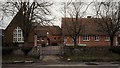
Steventon Primary School
The two main buildings by J W Hugall (left) and G E Street (right), linked by additions of about 1900.
Image: © Chris Brown
Taken: 19 Feb 2017
0.19 miles
10

Steventon Primary School
The schoolroom on the right was designed by G E Street in 1861-64; the former infants' school with the bellcote is by J W Hugall in 1871. The school is seen from the causeway and along with the North Star pub opposite marks the point where the village green ends and a village street, still known as the Causeway, continues to the church.
Image: © Chris Brown
Taken: 19 Feb 2017
0.19 miles