
IMAGES TAKEN NEAR TO
Ickleton Road, WANTAGE, OX12 9JA
Introduction
This page details the photographs taken nearby to Ickleton Road, OX12 9JA by members of the Geograph project.
The Geograph project started in 2005 with the aim of publishing, organising and preserving representative images for every square kilometre of Great Britain, Ireland and the Isle of Man.

There are currently over 7.5m images from over14,400 individuals and you can help contribute to the project by visiting https://www.geograph.org.uk
Image Map
Images are licensed for reuse under creativecommons.org/licenses/by-sa/2.0
Notes
- Clicking on the map will re-center to the selected point.
- The higher the marker number, the further away the image location is from the centre of the postcode.
Image Listing (54 Images Found)
Images are licensed for reuse under creativecommons.org/licenses/by-sa/2.0
Image
Details
Distance
1
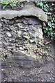
Wall on south side of Ickleton Road
Section of wall which is the probable site of the Ordnance Survey cut mark benchmark described on the Bench Mark Database at http://www.bench-marks.org.uk/bm23404
Image: © Roger Templeman
Taken: 20 Apr 2012
0.03 miles
2
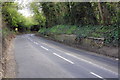
B4507 Ickeleton Road west of Wantage
It is probable that there was an OS benchmark on the end of the wall Image near the right side of the image.
Image: © Roger Templeman
Taken: 20 Apr 2012
0.05 miles
3
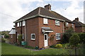
#13 Hamfield
There is an OS benchmark Image on the corner of the house to the left of the door
Image: © Roger Templeman
Taken: 20 Apr 2012
0.07 miles
4
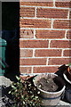
Benchmark on #13 Hamfield
Ordnance Survey cut mark benchmark described on the Bench Mark Database at http://www.bench-marks.org.uk/bm23397
Image: © Roger Templeman
Taken: 3 May 2011
0.07 miles
5
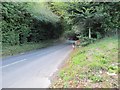
Bend on Ickleton Road
Ickleton road Wantage looking towards the Childery direction.
Image: © Bill Nicholls
Taken: 14 Aug 2011
0.08 miles
6
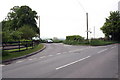
Turning to the Letcombe villages from the B4507, Ickleton Road
Left for Letcombe Bassett and Letcombe Regis, ahead for Childrey, Lambourn and Ashbury.
Image: © Roger Templeman
Taken: 26 Apr 2011
0.09 miles
7
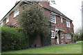
#1 Ham Cottages, Ickleton Road
There is very probably an Ordnance Survey cut mark benchmark (see http://www.bench-marks.org.uk/bm42754 ) concealed behind the ivy on the chimney breast
Image: © Roger Templeman
Taken: 20 Apr 2012
0.10 miles
8
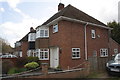
#46 Hamfield
There is an OS benchmark Image on the side of the house, left of the top of the pipe
Image: © Roger Templeman
Taken: 20 Apr 2012
0.10 miles
9
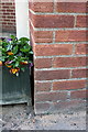
Benchmark on #46 Hamfield
Ordnance Survey cut mark benchmark described on the Bench Mark Database at http://www.bench-marks.org.uk/bm37782
Image: © Roger Templeman
Taken: 3 May 2011
0.10 miles
10
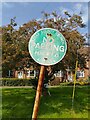
'NO PARKING PENALTY £1' sign close up
A sign on Hamfield in Wantage, installed by Berkshire County Council (when Wantage was in Berkshire, of course). The sign reads: "BERKS COUNTY COUNCIL
NO
PARKING
PENALTY £1
ACT 1953".
I doubt the penalty is enforced in 2023.
Image: © Oscar Taylor
Taken: 9 Oct 2023
0.10 miles