
IMAGES TAKEN NEAR TO
Ginge, WANTAGE, OX12 8QS
Introduction
This page details the photographs taken nearby to OX12 8QS by members of the Geograph project.
The Geograph project started in 2005 with the aim of publishing, organising and preserving representative images for every square kilometre of Great Britain, Ireland and the Isle of Man.

There are currently over 7.5m images from over14,400 individuals and you can help contribute to the project by visiting https://www.geograph.org.uk
Image Map
Images are licensed for reuse under creativecommons.org/licenses/by-sa/2.0
Notes
- Clicking on the map will re-center to the selected point.
- The higher the marker number, the further away the image location is from the centre of the postcode.
Image Listing (19 Images Found)
Images are licensed for reuse under creativecommons.org/licenses/by-sa/2.0
Image
Details
Distance
1
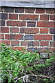
Benchmark on Manor Farm barn
Ordnance Survey cut mark benchmark described on the Bench Mark Database at http://www.bench-marks.org.uk/bm42839
Image: © Roger Templeman
Taken: 3 May 2012
0.09 miles
2
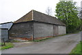
Barn of Manor Farm, Ginge Road
There is an OS benchmark Image on the road face of the facing corner
Image: © Roger Templeman
Taken: 3 May 2012
0.09 miles
3
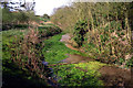
Old Cress Bed at Ginge
The Ginge Brook starts about 20 metres behind me in this shot, welling out of springs and small fissures in a chalky hollow.
You can see that it's already quite a healthy stream, and the bed has been graded into cress beds. Just to the left is a derelict shed that I am guessing was used as a store when the cress was being harvested.
Cress is still growing here, as it does in many similar locations, but I'm never sure whether it's wise to eat it with all the scary stories you hear about liver flukes and stuff.
Image: © Des Blenkinsopp
Taken: 6 Apr 2011
0.10 miles
4
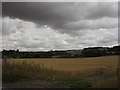
Looking over the fields
Towards East Ginge. The buildings in the picture are at East Ginge. Picture taken from the end of the track to Red Barn, just to the west of West Ginge.
Image: © andrew auger
Taken: 7 Aug 2010
0.10 miles
7
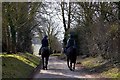
Racehorses exercising on the bridleway
Racehorses from Henrietta Knight's stable in West Ginge exercising for Cheltenham.
Image: © Steve Daniels
Taken: 15 Mar 2010
0.11 miles
8
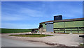
Farm Building at Ginge
These sort of places always look bleak, even on a nice day like this.
Image: © Des Blenkinsopp
Taken: 6 Apr 2011
0.12 miles
9
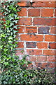
Benchmark on residence at Upper Farm
Ordnance Survey cut mark benchmark described on the Bench Mark Database at http://www.bench-marks.org.uk/bm42377
Image: © Roger Templeman
Taken: 3 May 2012
0.12 miles
10

Stable block and house at Upper Farm beside bridleway
There is an OS benchmark Image on the house wall to the left of the near buttress
Image: © Roger Templeman
Taken: 3 May 2012
0.12 miles