IMAGES TAKEN NEAR TO
Westfield Way, WANTAGE, OX12 7EP
Introduction
This page details the photographs taken nearby to Westfield Way, OX12 7EP by members of the Geograph project.
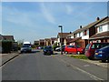
The Geograph project started in 2005 with the aim of publishing, organising and preserving representative images for every square kilometre of Great Britain, Ireland and the Isle of Man.

There are currently over 7.5m images from over14,400 individuals and you can help contribute to the project by visiting https://www.geograph.org.uk
Image Map (Loading...)


Getting Data...Please wait
Leaflet Map data © OpenStreetMap
Images are licensed for reuse under creativecommons.org/licenses/by-sa/2.0
Notes
- Clicking on the map will re-center to the selected point.
- The higher the marker number, the further away the image location is from the centre of the postcode.
Image Listing (21 Images Found)
Images are licensed for reuse under creativecommons.org/licenses/by-sa/2.0
Image
Details
Distance
1
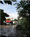
On the Scrap Heap
One of the no doubt many copies of the iconic "Only Fools and Horses" 3 wheelers ends its days at the top of the heap in this yard on the edge of Charlton village.
Image: © Des Blenkinsopp
Taken: 30 Sep 2010
0.04 miles
2
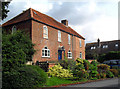
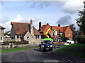
Parsonage Farm House
Most of Charlton is post WW2. This is one of the originals.
Image: © Des Blenkinsopp
Taken: 30 Sep 2010
0.11 miles
3
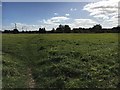
Path to Port Way
From Crabhill Lane the path to Port Way
Image: © Shaun Ferguson
Taken: 3 Oct 2017
0.14 miles
4
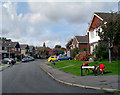
Bryan Way
The surrounding streets are similar to this.
Image: © Des Blenkinsopp
Taken: 30 Sep 2010
0.15 miles
5
Bryan Way, Charlton, Wantage
Viewed from the junction with Aldworth Avenue.
Image: © Andrew Smith
Taken: 9 Apr 2011
0.16 miles
6
Mending the Light
Street light repairs in front of what looks like the old village school.
Image: © Des Blenkinsopp
Taken: 30 Sep 2010
0.16 miles
7
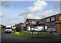
Other End of Bryan Way
Featuring Charlton Post Office and the Chiropractic Centre.
Image: © Des Blenkinsopp
Taken: 30 Sep 2010
0.16 miles
8
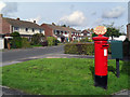
Barnards Way
Outside Charlton Post Office.
Image: © Des Blenkinsopp
Taken: 30 Sep 2010
0.17 miles
9
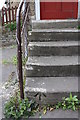
Benchmark on bottom step to Parish Hall
Ordnance Survey rivet benchmark described on the Bench Mark Database at http://www.bench-marks.org.uk/bm37730
Image: © Roger Templeman
Taken: 26 Apr 2011
0.17 miles
10
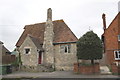
Charlton Parish Hall, #34 Charlton Village Road
Image: © Roger Templeman
Taken: 26 Apr 2011
0.17 miles