IMAGES TAKEN NEAR TO
Ashfields Lane, WANTAGE, OX12 0HN
Introduction
This page details the photographs taken nearby to Ashfields Lane, OX12 0HN by members of the Geograph project.
The Geograph project started in 2005 with the aim of publishing, organising and preserving representative images for every square kilometre of Great Britain, Ireland and the Isle of Man.

There are currently over 7.5m images from over14,400 individuals and you can help contribute to the project by visiting https://www.geograph.org.uk
Image Map (Loading...)


Getting Data...Please wait
Leaflet Map data © OpenStreetMap
Images are licensed for reuse under creativecommons.org/licenses/by-sa/2.0
Notes
- Clicking on the map will re-center to the selected point.
- The higher the marker number, the further away the image location is from the centre of the postcode.
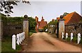
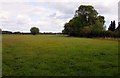
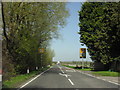
Image Listing (28 Images Found)
Images are licensed for reuse under creativecommons.org/licenses/by-sa/2.0
Image
Details
Distance
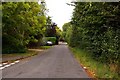
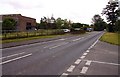
3
The A338 out of East Hanney
Heading generally north towards Frilford.
Image: © andrew auger
Taken: 17 Apr 2010
0.09 miles
7
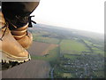
Aerial view from Paramotor of East Hanney
Grove in distance
Image: © Dave Price
Taken: 10 Sep 2006
0.12 miles
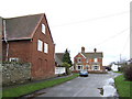
8
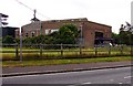
Vale Housing Association Depot in East Hanney
Image: © Steve Daniels
Taken: 1 Sep 2009
0.12 miles
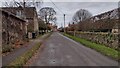
9
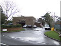
Vale Housing Association offices
Image: © Jonathan Billinger
Taken: 10 Jan 2007
0.14 miles