
IMAGES TAKEN NEAR TO
Thames Street, OXFORD, OX1 1TR
Introduction
This page details the photographs taken nearby to Thames Street, OX1 1TR by members of the Geograph project.
The Geograph project started in 2005 with the aim of publishing, organising and preserving representative images for every square kilometre of Great Britain, Ireland and the Isle of Man.

There are currently over 7.5m images from over14,400 individuals and you can help contribute to the project by visiting https://www.geograph.org.uk
Image Map
Images are licensed for reuse under creativecommons.org/licenses/by-sa/2.0
Notes
- Clicking on the map will re-center to the selected point.
- The higher the marker number, the further away the image location is from the centre of the postcode.
Image Listing (896 Images Found)
Images are licensed for reuse under creativecommons.org/licenses/by-sa/2.0
Image
Details
Distance
1
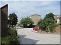
Friars Wharf
Friars Wharf, this was wasteland with some old derelict warehouses on it when I first started work in Oxford.
Image: © Bill Nicholls
Taken: 30 Jun 2009
0.01 miles
2
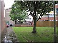
Friars Wharf
Part of the Friars Wharf area.
Image: © Bill Nicholls
Taken: 8 Jul 2009
0.01 miles
3
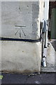
Benchmark on Wharf House, Thames Street
Ordnance Survey cut mark benchmark described on the Bench Mark Database at http://www.bench-marks.org.uk/bm22882
Image: © Roger Templeman
Taken: 24 Oct 2013
0.01 miles
4
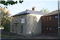
The Wharf House, Thames Street
There is an OS benchmark Image on the near corner of this long-time closed pub on the face with the pub sign. The building has been converted to 4 small duplex apartments keeping the original facade but changed at the rear.
Image: © Roger Templeman
Taken: 24 Oct 2013
0.02 miles
5

Writing on the wall
They made a good job of scrubbing out the writing on the side of the old pub.
Image: © Bill Nicholls
Taken: 30 Jun 2009
0.03 miles
6
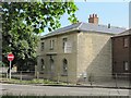
The Wharf House
View of the Wharf House from across Thames Street.
Image: © Bill Nicholls
Taken: 30 Jun 2009
0.03 miles
7
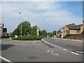
Speedwell Street
Speedwell Street to the right here was part of the old one way system until the council messed it all up and discouraged motorists.
Image: © Bill Nicholls
Taken: 30 Jun 2009
0.04 miles
8
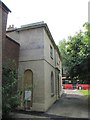
The wharf house
This was a pub at one time. Obviously it was not making money.
Image: © Bill Nicholls
Taken: 30 Jun 2009
0.04 miles
9

Pub sign
They even got rid of the old pub sign in favour of their own.
Image: © Bill Nicholls
Taken: 30 Jun 2009
0.04 miles
10
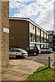
Preachers Lane
Part of a small housing estate bounded by the A420, River Thames and the Old Navigation (Castle Mill Stream). This view is from the A420.
Image: © Martin Addison
Taken: 11 Aug 2010
0.04 miles