
IMAGES TAKEN NEAR TO
Fisher Row, OXFORD, OX1 1HT
Introduction
This page details the photographs taken nearby to Fisher Row, OX1 1HT by members of the Geograph project.
The Geograph project started in 2005 with the aim of publishing, organising and preserving representative images for every square kilometre of Great Britain, Ireland and the Isle of Man.

There are currently over 7.5m images from over14,400 individuals and you can help contribute to the project by visiting https://www.geograph.org.uk
Image Map
Images are licensed for reuse under creativecommons.org/licenses/by-sa/2.0
Notes
- Clicking on the map will re-center to the selected point.
- The higher the marker number, the further away the image location is from the centre of the postcode.
Image Listing (1252 Images Found)
Images are licensed for reuse under creativecommons.org/licenses/by-sa/2.0
Image
Details
Distance
1

Upstream to the tower
View upstream towards the tower at the gaol. The millstream is to the right
Image: © Bill Nicholls
Taken: 30 Jun 2009
0.01 miles
2

Lower Fisher Row Gardens
An information board nearby says that this small public garden was created in 1954 after the demolition of some old houses by the river.
Image: © Stephen Craven
Taken: 24 Sep 2022
0.01 miles
3

Weir by the tower
View of the millstream by the gaol tower. To the left you can make out the race that worked the wheel which was possibly where the gap can be seen at the race entrance.
Image: © Bill Nicholls
Taken: 30 Jun 2009
0.01 miles
4
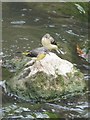
Grey Wagtails on a rock
Flitting about on the rocks near where the stream runs under another bridge near Oxford castle
Image: © Bill Nicholls
Taken: 30 Jun 2009
0.01 miles
5

Oxford Prison transformed
There has been a prison on this site since the C11, originally contained within the Norman castle. In the 1785 it was rebuilt behind a curtain wall, with two wings: one for debtors, one for felons. Later in the C18 a house of correction was added with separate wings for men and women. Executions were carried out in St George's Tower, the last one being in 1863. It was enlarged in the C19 and became HM Prison Oxford. It finally closed in 1996 and the building and site have since been ambitiously developed to include an upmarket hotel, shops, restaurants and a heritage centre.
Image: © Natasha Ceridwen de Chroustchoff
Taken: 3 Mar 2008
0.01 miles
6

Stone dog by the Malthouse
No explanation has been found for this noble piece of canine statuary which stands, or rather sits, outside the old malthouse beside the Castle Mill Stream, and which can be seen from The Quaking Bridge.
Image: © Natasha Ceridwen de Chroustchoff
Taken: 3 Nov 2009
0.01 miles
7

Castle Mill Stream viewed from Quaking Bridge, Oxford
A view north along a backwater of the River Thames. Fisher Row is on the left.
Image: © Jaggery
Taken: 31 Mar 2013
0.01 miles
8
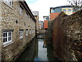
Wareham Stream, Oxford
A view NNW from St Thomas Street towards a footbridge. Wareham Stream is a 500 metre long open channel in the city centre, extending from a weir in Upper Fisher Row to Castle Mill Stream near Oxford & Cherwell Valley College.
Image: © Jaggery
Taken: 31 Mar 2013
0.02 miles
9

The Old Malthouse by Mill Stream
Looking SSE along the Mill Stream, past the Old Malthouse towards Quaking Bridge in the distance.
Image: © David P Howard
Taken: 3 Dec 2011
0.02 miles
10
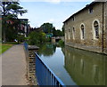
The restored Old Malthouse on the Castle Mill Stream
Image: © Mat Fascione
Taken: 15 Jun 2015
0.02 miles