IMAGES TAKEN NEAR TO
Finham Brook, DIDCOT, OX11 7YE
Introduction
This page details the photographs taken nearby to Finham Brook, OX11 7YE by members of the Geograph project.
The Geograph project started in 2005 with the aim of publishing, organising and preserving representative images for every square kilometre of Great Britain, Ireland and the Isle of Man.

There are currently over 7.5m images from over14,400 individuals and you can help contribute to the project by visiting https://www.geograph.org.uk
Image Map (Loading...)


Getting Data...Please wait
Leaflet Map data © OpenStreetMap
Images are licensed for reuse under creativecommons.org/licenses/by-sa/2.0
Notes
- Clicking on the map will re-center to the selected point.
- The higher the marker number, the further away the image location is from the centre of the postcode.
Image Listing (32 Images Found)
Images are licensed for reuse under creativecommons.org/licenses/by-sa/2.0
Image
Details
Distance
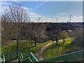
1
Brunstock Beck
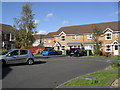
1990s houses in Ladygrove.
Image: © Burgess Von Thunen
Taken: 18 Oct 2011
0.06 miles
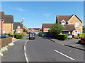
3
Avon Way, Didcot
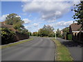
Connecting one suburb to another.
Image: © Oscar Taylor
Taken: 3 Mar 2024
0.08 miles
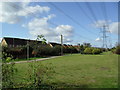
4
Ladygrove
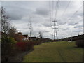
Power lines in Didcot.
Image: © Burgess Von Thunen
Taken: 21 Feb 2012
0.09 miles
5
Ladygrove, Didcot
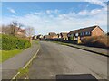
A large area of Didcot.
Image: © Oscar Taylor
Taken: 3 Mar 2024
0.10 miles
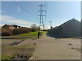
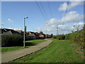
6
Ladygrove
Power lines in Didcot.
Image: © Burgess Von Thunen
Taken: 18 Oct 2011
0.10 miles
7
Brunstock Beck, Didcot
Many of the roads in this part of the town take their names from streams, others from rivers.
Image: © Andrew Smith
Taken: 3 Jun 2006
0.11 miles
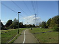
8
National Cycle Route 5 towards Ladygrove Hill
Here the shared path crosses Avon Way.
Image: © Oscar Taylor
Taken: 3 Mar 2024
0.11 miles
9
Ladygrove
Power lines in Didcot.
Image: © Burgess Von Thunen
Taken: 18 Oct 2011
0.11 miles
10
Ladygrove
Power lines in Didcot.
Image: © Burgess Von Thunen
Taken: 18 Oct 2011
0.11 miles