
IMAGES TAKEN NEAR TO
The Croft, DIDCOT, OX11 0ED
Introduction
This page details the photographs taken nearby to The Croft, OX11 0ED by members of the Geograph project.
The Geograph project started in 2005 with the aim of publishing, organising and preserving representative images for every square kilometre of Great Britain, Ireland and the Isle of Man.

There are currently over 7.5m images from over14,400 individuals and you can help contribute to the project by visiting https://www.geograph.org.uk
Image Map
Images are licensed for reuse under creativecommons.org/licenses/by-sa/2.0
Notes
- Clicking on the map will re-center to the selected point.
- The higher the marker number, the further away the image location is from the centre of the postcode.
Image Listing (49 Images Found)
Images are licensed for reuse under creativecommons.org/licenses/by-sa/2.0
Image
Details
Distance
1

Into Harwell
The village of Harwell as you come down Grove Road
Image: © Bill Nicholls
Taken: 19 May 2026
0.07 miles
2
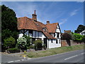
Old House, Harwell Village
The building beyond, with the small pitched roof and chimney, is the tower of the old Harwell Brewery.
Image: © Des Blenkinsopp
Taken: 10 Jan 2009
0.09 miles
3
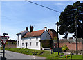
Old Brewery, Harwell
The brewery tower is partly visible behind the house.
I vaguely remember this as being owned by Davenports Brewery, itself now long gone.
When was beer last made here, anyone?
Image: © Des Blenkinsopp
Taken: 6 Apr 2011
0.09 miles
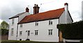
5
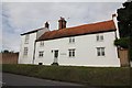
Another old Pub
Need to check on the name but I'm sure this was a pub at one time though I can only remember Davenports name associated with the place.
Image: © Bill Nicholls
Taken: 28 Aug 2011
0.11 miles
6
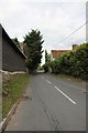
Grove Road
Grove Road which used to link up with the A34 now the A4130.
Image: © Bill Nicholls
Taken: 28 Aug 2011
0.11 miles
7
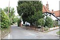
The Barrow
Or Barrow lane as it is on the map just off Drewitts Corner in Harwell.
Image: © Bill Nicholls
Taken: 28 Aug 2011
0.12 miles
8
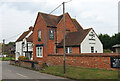
The Hart of Hartwell
Public House, Hartwell.
Image: © Wayland Smith
Taken: 18 Oct 2020
0.12 miles
9
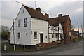
The Hart of Harwell public house
There is an OS benchmark Image on the steps of the pub which was formerly called The White Hart.
Image: © Roger Templeman
Taken: 7 Feb 2012
0.12 miles
10
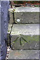
Benchmark on the steps to the Hart of Harwell pub
Ordnance Survey rivet benchmark described on the Bench Mark Database at http://www.bench-marks.org.uk/bm23352
Image: © Roger Templeman
Taken: 7 Feb 2012
0.12 miles